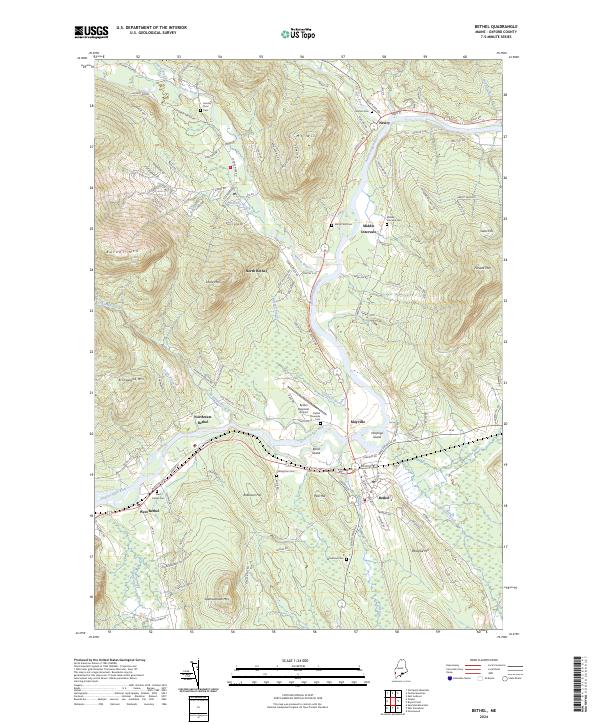
2024 Map of Bethel
USGS Topo · Published 2024About this map
Androscoggin River and its numerous tributaries, including the Sunday River and Bear River, dominate this modern topography of Oxford County. The landscape is characterized by prominent peaks like Mt Will, Barker Mtn, and Locke Mtn, which define the narrow valleys where local settlements have taken root. The village of Bethel serves as a central hub, connected by the St Lawrence & Atlantic RR and the Bethel Regional Airport.
Find a feature on this map
120 named features on this map. Tap any name to fly to it.
Don’t see what you’re looking for? This feature index may not catch every label — zoom into the map to look around manually.
Map Details
Editions of this 2024 Bethel Map
This is the sole edition of this map. No revisions or reprints were ever made.
Other maps of this area

1911 · Bryant Pond
USGS Topo · 1:62,500

1914 · Bethel
USGS Topo · 1:62,500

1914 · Bryant Pond
USGS Topo · 1:62,500

1927 · Rumford
USGS Topo · 1:48,000

1930 · Rumford
USGS Topo · 1:62,500

1940 · Bethel
USGS Topo · 1:62,500

1941 · Bethel
USGS Topo · 1:62,500

1942 · Bryant Pond
USGS Topo · 1:62,500

1943 · Old Speck Mtn
USGS Topo · 1:62,500

1945 · Old Speck Mtn
USGS Topo · 1:62,500