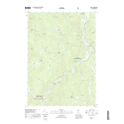
2018 Map of Bethel
USGS Topo · Published 2018About this map
White River and its major tributaries, including Third Branch White River and Stony Brook, carve through the mountainous terrain of Windsor County. The village of Gaysville serves as a focal point along the river, while smaller settlements like Lilliesville, Lympus, and Camp Brook are connected by winding mountain roads such as Camp Brook Rd and Lillieville Rd. For local historians and genealogists, the map identifies several burial sites including the Sylvester Plot Cem, Abbott Cem, and the Mount Pleasant Cem near Riverside. Significant landmarks include the White River National Fish Hatchery and the Gilead Brook Covered Bridge near an Old Church. Much of the western landscape is protected within the Green Mountain National Forest, where peaks like Rochester Mtn and Pauls Peak rise above the gaps.
Find a feature on this map
89 named features on this map. Tap any name to fly to it.
Don’t see what you’re looking for? This feature index may not catch every label — zoom into the map to look around manually.
Map Details
Editions of this 2018 Bethel Map
This is the sole edition of this map. No revisions or reprints were ever made.
Other maps of this area

1891 · Rutland
USGS Topo · 1:62,500

1893 · Rutland
USGS Topo · 1:62,500

1911 · Woodstock
USGS Topo · 1:62,500

1913 · Woodstock
USGS Topo · 1:62,500

1915 · Rochester
USGS Topo · 1:62,500

1917 · Rochester
USGS Topo · 1:62,500

1919 · Royalton
USGS Topo · 1:62,500

1924 · Randolph
USGS Topo · 1:48,000

1926 · Randolph
USGS Topo · 1:62,500

1943 · Woodstock
USGS Topo · 1:62,500