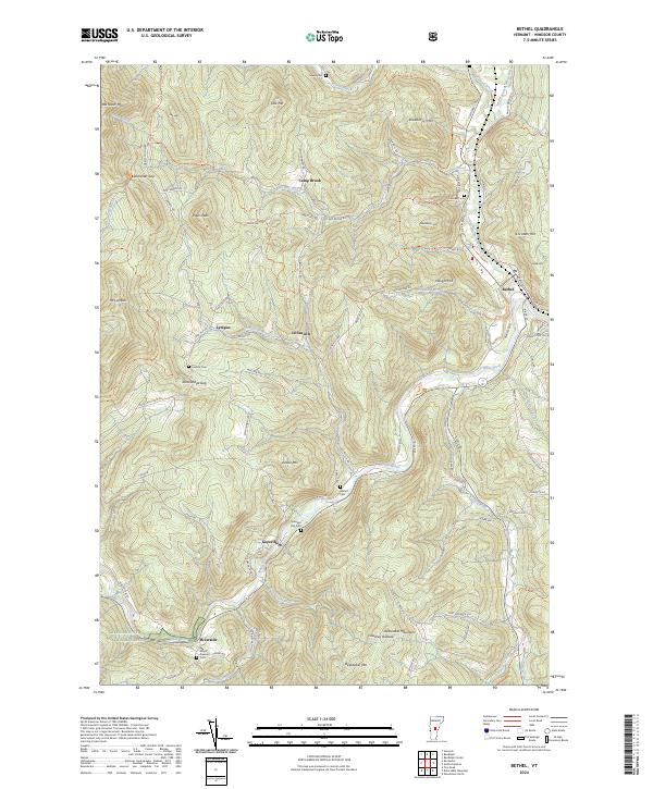
2024 Map of Bethel
USGS Topo · Published 2024About this map
The Third Branch White River and the main stem of the White River converge near the settlement of Bethel, forming a topographical focal point for this Vermont landscape. The terrain is defined by significant elevations including Pauls Peak, Rochester Mtn, and Delectable Mountain, which frame narrow valleys where small communities like Gaysville, Lympus, and Lilliesville have persisted. The distribution of small burial sites such as Sylvester Plot Cem and Abbott Cem suggests a long history of family-based landholdings scattered along the watercourses.
Find a feature on this map
94 named features on this map. Tap any name to fly to it.
Don’t see what you’re looking for? This feature index may not catch every label — zoom into the map to look around manually.
Map Details
Editions of this 2024 Bethel Map
This is the sole edition of this map. No revisions or reprints were ever made.
Other maps of this area

1891 · Rutland
USGS Topo · 1:62,500

1893 · Rutland
USGS Topo · 1:62,500

1911 · Woodstock
USGS Topo · 1:62,500

1913 · Woodstock
USGS Topo · 1:62,500

1915 · Rochester
USGS Topo · 1:62,500

1917 · Rochester
USGS Topo · 1:62,500

1919 · Royalton
USGS Topo · 1:62,500

1924 · Randolph
USGS Topo · 1:48,000

1926 · Randolph
USGS Topo · 1:62,500

1943 · Woodstock
USGS Topo · 1:62,500