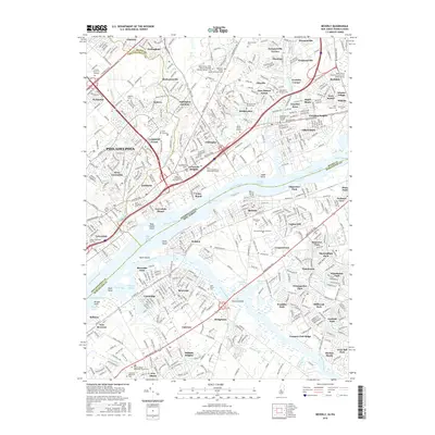
2016 Map of Beverly
USGS Topo · Published 2016About this map
The Delaware River serves as the central artery for this cross-border region, separating the industrial and residential corridors of Bucks and Philadelphia Counties in Pennsylvania from Delanco and Riverside in New Jersey. The Pennsylvania side is characterized by dense suburban growth and historical religious landmarks, including the Saint Mary's Lithuanian National Catholic Cemetery and the Sisters of the Blessed Sacrament Cemetery. Transport infrastructure follows the river's curve, with the Bristol Pike and Pennsylvania Avenue facilitating movement between settlements like Andalusia and Eddington.
Find a feature on this map
116 named features on this map. Tap any name to fly to it.
Don’t see what you’re looking for? This feature index may not catch every label — zoom into the map to look around manually.
Map Details
Editions of this 2016 Beverly Map
This is the sole edition of this map. No revisions or reprints were ever made.
Other maps of this area

1888 · Mount Holly
USGS Topo · 1:62,500

1890 · Burlington
USGS Topo · 1:62,500

1891 · Philadelphia
USGS Topo · 1:62,500

1893 · Germantown
USGS Topo · 1:62,500

1893 · Burlington
USGS Topo · 1:62,500

1894 · Mount Holly
USGS Topo · 1:62,500

1894 · Philadelphia
USGS Topo · 1:62,500

1894 · Germantown
USGS Topo · 1:62,500

1896 · Germantown
USGS Topo · 1:62,500

1896 · Philadelphia
USGS Topo · 1:62,500
Featured Places
- Philadelphia, PA
- Bensalem Township, PA
- Mount Laurel Township, NJ
- Willingboro Township, NJ
- Moorestown Township, NJ