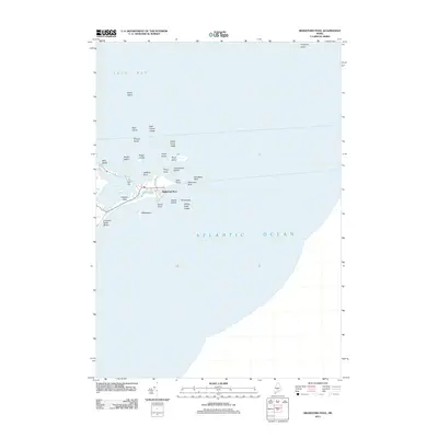
2011 Map of Biddeford Pool
USGS Topo · Published 2011About this map
Biddeford Pool and the residential peninsula of Hills Beach anchor this coastal survey, where the Saco River estuary meets the Atlantic. The landscape is defined by its maritime geography, protecting The Bay and the shallow waters of Great Pond from the open sea. Numerous rocky outposts and navigation hazards dot the entrance to Saco Bay, including Wood Island, Stage Island, and the treacherous Ram Island Ledge. On the mainland, Fletcher Neck and Fort Hill provide topographic high points overlooking a complex network of shoreline features like East Point and South Point. The map details the modern road network along Hills Beach Rd and Saint Martins Ln, illustrating the density of coastal development in York County at the start of the 2010s.
Find a feature on this map
33 named features on this map. Tap any name to fly to it.
Don’t see what you’re looking for? This feature index may not catch every label — zoom into the map to look around manually.
Map Details
Editions of this 2011 Biddeford Pool Map
This is the sole edition of this map. No revisions or reprints were ever made.
Other maps of this area

1891 · Portland
USGS Topo · 1:62,500

1891 · Biddeford
USGS Topo · 1:62,500

1893 · Biddeford
USGS Topo · 1:62,500

1893 · Portland
USGS Topo · 1:62,500

1893 · Casco Bay
USGS Topo · 1:62,500

1914 · Portland
USGS Topo · 1:48,000

1914 · Casco Bay
USGS Topo · 1:48,000

1916 · Portland
USGS Topo · 1:62,500

1916 · Casco Bay
USGS Topo · 1:62,500

1916 · Portland And Vicinity
USGS Topo · 1:62,500