
1893 Map of Portland
USGS Topo · Published 1893About this map
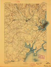
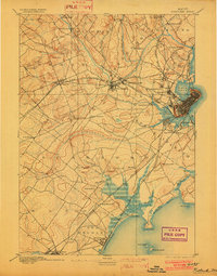
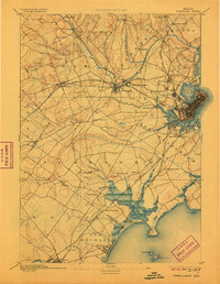
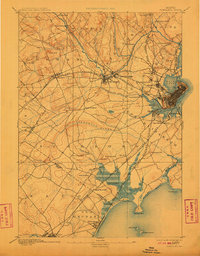
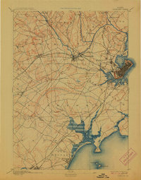
The industrial and maritime core of Portland serves as the focal point for this 1889 survey, where the Fore River and Back Cove define the city's peninsula. A dense network of steam-era transportation radiates from the hub, including the Grand Trunk Railroad and the Portland and Ogdensburg Railroad. Beyond the urban center, the landscape transitions into the mill villages of Westbrook, specifically the industrial clusters at Saccarappa and Cumberland Mills along the Presumpscot River.
Find a feature on this map
67 named features on this map. Tap any name to fly to it.
Don’t see what you’re looking for? This feature index may not catch every label — zoom into the map to look around manually.
Map Details
Editions of this 1893 Portland Map
6 editions found
Other maps of this area

1891 · Portland
USGS Topo · 1:62,500

1891 · Biddeford
USGS Topo · 1:62,500

1891 · Kennebunk
USGS Topo · 1:62,500

1891 · Buxton
USGS Topo · 1:62,500

1892 · Freeport
USGS Topo · 1:62,500

1892 · Buxton
USGS Topo · 1:62,500

1893 · Kennebunk
USGS Topo · 1:62,500

1893 · Biddeford
USGS Topo · 1:62,500

1893 · Casco Bay
USGS Topo · 1:62,500

1893 · Buxton
USGS Topo · 1:62,500