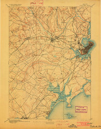
1893 Map of Portland
USGS Topo · Published 1902About this map
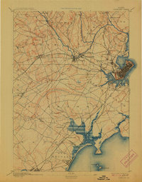
Portland stands at the heart of this coastal Maine landscape, flanked by a dense concentration of Victorian-era satellite villages and an intricate rail network. The survey captures the industrial energy of the late 19th century, with significant milling and transportation hubs at Saccarappa and Cumberland Mills along the Presumpscot River. This river, with its dramatic drops at Gambo Falls and Presumpscot Falls, powered the region's early development long before suburban sprawl unified these distinct settlements.
Find a feature on this map
67 named features on this map. Tap any name to fly to it.
Don’t see what you’re looking for? This feature index may not catch every label — zoom into the map to look around manually.
Map Details
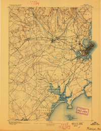
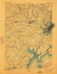
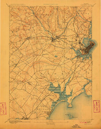
Editions of this 1893 Portland Map
6 editions found
Other maps of this area

1891 · Portland
USGS Topo · 1:62,500

1891 · Biddeford
USGS Topo · 1:62,500

1891 · Kennebunk
USGS Topo · 1:62,500

1891 · Buxton
USGS Topo · 1:62,500

1892 · Freeport
USGS Topo · 1:62,500

1892 · Buxton
USGS Topo · 1:62,500

1893 · Kennebunk
USGS Topo · 1:62,500

1893 · Biddeford
USGS Topo · 1:62,500

1893 · Portland
USGS Topo · 1:62,500

1893 · Casco Bay
USGS Topo · 1:62,500