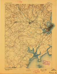
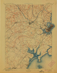
1893 Map of Portland
USGS Topo · Published 1898About this map
The dense industrial and rail corridor of the Presumpscot River and the bustling harbor of Portland anchor this late 19th-century coastal survey. The map details a landscape in transition, where the expanding rail infrastructure of the Maine Central Railroad and the Portland and Rochester Railroad connect manufacturing hubs like Saccarappa and Cumberland Mills to the sea. To the south, the settlement pattern shifts toward the coast, following the Boston and Maine Railroad Eastern Division through Scarboro toward the developing seaside resort at Old Orchard.
Find a feature on this map
63 named features on this map. Tap any name to fly to it.
Don’t see what you’re looking for? This feature index may not catch every label — zoom into the map to look around manually.
Map Details
Editions of this 1893 Portland Map
6 editions found
Other maps of this area

1891 · Portland
USGS Topo · 1:62,500

1891 · Biddeford
USGS Topo · 1:62,500

1891 · Kennebunk
USGS Topo · 1:62,500

1891 · Buxton
USGS Topo · 1:62,500

1892 · Freeport
USGS Topo · 1:62,500

1892 · Buxton
USGS Topo · 1:62,500

1893 · Kennebunk
USGS Topo · 1:62,500

1893 · Biddeford
USGS Topo · 1:62,500

1893 · Portland
USGS Topo · 1:62,500

1893 · Casco Bay
USGS Topo · 1:62,500