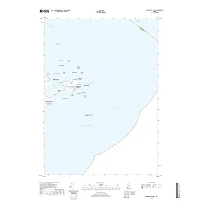
2018 Map of Biddeford Pool
USGS Topo · Published 2018About this map
Biddeford Pool and the surrounding coastline of Saco Bay define this maritime landscape in the late 2010s. The geography is characterized by narrow barrier beaches and rocky islands that shelter The Pool from the open Atlantic Ocean. Settlements like Hills Beach and Fortunes Rocks are connected by coastal roads such as Ocean Ave, illustrating the modern residential layout of these historic summer communities. Offshore, an intricate network of hazards and navigational landmarks remains clearly charted, including Wood Island, Stage Island, and several ledges like Threetree Ledge and Whale Rock Ledge. The transition from the sandy expanse of Fortunes Rocks Beach to the tidal flats of the Town Thatch Bed highlights the diverse coastal ecology protected by the arm of Fletcher Neck.
Find a feature on this map
41 named features on this map. Tap any name to fly to it.
Don’t see what you’re looking for? This feature index may not catch every label — zoom into the map to look around manually.
Map Details
Editions of this 2018 Biddeford Pool Map
This is the sole edition of this map. No revisions or reprints were ever made.
Other maps of this area

1891 · Portland
USGS Topo · 1:62,500

1891 · Biddeford
USGS Topo · 1:62,500

1893 · Biddeford
USGS Topo · 1:62,500

1893 · Portland
USGS Topo · 1:62,500

1893 · Casco Bay
USGS Topo · 1:62,500

1914 · Portland
USGS Topo · 1:48,000

1914 · Casco Bay
USGS Topo · 1:48,000

1916 · Portland
USGS Topo · 1:62,500

1916 · Casco Bay
USGS Topo · 1:62,500

1916 · Portland And Vicinity
USGS Topo · 1:62,500