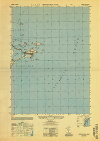
1949 Map of Biddeford Pool
USGS Topo · Published 1949About this map
Biddeford Pool sits at the heart of this coastal study, marking the southern edge of Saco Bay where the mainland meets the Atlantic. The map emphasizes the maritime hazards and navigational aids essential to this stretch of the Maine coast, including the Wood Island Lighthouse and the Monument on Stage I. The geography is defined by the narrow Fletcher Neck, which shelters the tidal waters of The Pool from the open ocean. Coastal life in the late 1940s is represented by small settlements like Libbyshears and the residential clusters along Hill Beach. Beyond the harbor, a scattered archipelago including Negro I, Gooseberry I, and Beach Island creates a complex seascape of reefs and rocky points like Halftide Rk and Dansbury Reef.
Find a feature on this map
24 named features on this map. Tap any name to fly to it.
Don’t see what you’re looking for? This feature index may not catch every label — zoom into the map to look around manually.
Map Details
Editions of this 1949 Biddeford Pool Map
This is the sole edition of this map. No revisions or reprints were ever made.
Other maps of this area

1891 · Portland
USGS Topo · 1:62,500

1891 · Biddeford
USGS Topo · 1:62,500

1893 · Biddeford
USGS Topo · 1:62,500

1893 · Portland
USGS Topo · 1:62,500

1893 · Casco Bay
USGS Topo · 1:62,500

1914 · Portland
USGS Topo · 1:48,000

1914 · Casco Bay
USGS Topo · 1:48,000

1916 · Portland
USGS Topo · 1:62,500

1916 · Casco Bay
USGS Topo · 1:62,500

1916 · Portland And Vicinity
USGS Topo · 1:62,500