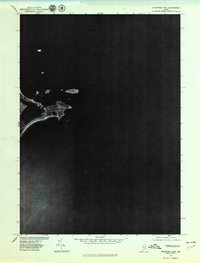
1975 Map of Biddeford Pool
USGS Topo · Published 1979About this map
Biddeford Pool stands as the primary focus of this coastal Maine orthophotograph, captured in the mid-1970s. The settlement's unique geography is clearly defined, situated on a peninsula that separates the sheltered waters of The Pool from the open Atlantic Ocean. This specialized aerial survey provides a photographic record of the shoreline and coastal development as it existed before the expansion of modern beachfront infrastructure. To the north, the expanse of Saco Bay meets the mainland, while the coastline curves southward toward Fortunes Rocks. Produced by the U.S. Geological Survey in cooperation with the Soil Conservation Service, this imagery offers a direct visual representation of the land-use patterns and natural topography of the York County coast during this era.
Find a feature on this map
5 named features on this map. Tap any name to fly to it.
Don’t see what you’re looking for? This feature index may not catch every label — zoom into the map to look around manually.
Map Details
Editions of this 1975 Biddeford Pool Map
This is the sole edition of this map. No revisions or reprints were ever made.
Other maps of this area

1891 · Portland
USGS Topo · 1:62,500

1891 · Biddeford
USGS Topo · 1:62,500

1893 · Biddeford
USGS Topo · 1:62,500

1893 · Portland
USGS Topo · 1:62,500

1893 · Casco Bay
USGS Topo · 1:62,500

1914 · Portland
USGS Topo · 1:48,000

1914 · Casco Bay
USGS Topo · 1:48,000

1916 · Portland
USGS Topo · 1:62,500

1916 · Casco Bay
USGS Topo · 1:62,500

1916 · Portland And Vicinity
USGS Topo · 1:62,500