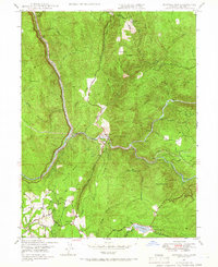
1947 Map of Bidwell Bar
USGS Topo · Published 1966About this map
Feather River waters converge in this late 1940s landscape, where the confluence of the North Fork and Middle Fork centers on the historic Bidwell Bar State Park. The terrain is defined by steep ridges like Kelly Ridge and prominent heights such as Stringtown Mtn and Mt Hope. This era captures the region's diverse rural economy, from mining operations at the Quartz Mine to specialized ranching at Miners Ranch and Buffalo Ranch. The southern portion of the map shows the transition to established infrastructure near Lake Wyandotte, where the Atkins Sch served the local community. Significant transit corridors, including the Western Pacific railroad and the Ponderosa Way, illustrate how the rugged topography was navigated for industry and recreation before the landscape was altered by mid-century water management projects.
Find a feature on this map
43 named features on this map. Tap any name to fly to it.
Don’t see what you’re looking for? This feature index may not catch every label — zoom into the map to look around manually.
Map Details
Editions of this 1947 Bidwell Bar Map
3 editions found
Other maps of this area

1888 · Marysville
USGS Topo · 1:125,000

1888 · Smartsville
USGS Topo · 1:125,000

1888 · Bidwell Bar
USGS Topo · 1:125,000

1891 · Bidwell Bar
USGS Topo · 1:125,000

1891 · Chico
USGS Topo · 1:125,000

1891 · Marysville
USGS Topo · 1:125,000

1891 · Smartsville
USGS Topo · 1:125,000

1892 · Smartsville
USGS Topo · 1:125,000

1893 · Chico
USGS Topo · 1:125,000

1893 · Bidwell Bar
USGS Topo · 1:125,000