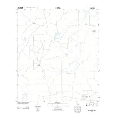
2013 Map of Biel Lake South
USGS Topo · Published 2013About this map
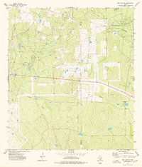
Las Mujeres Ranch and La Volanta Windmill anchor this 2013 topographic survey of the arid Webb County brushland. The landscape is defined by its drainage network, where the intermittent Black Cr flows south into Mesquitoso Cr, and the northern reaches are marked by Biel Lake. The presence of the Tai Vez Oil Field in the southeastern corner points to the region's industrial ties to energy production. Between the shallow canyons of Arroyo de Charco Escondido and the meandering path of Torres Cr, the map reveals a remote ranching territory crisscrossed by section lines and local roads like Co RD. The sparse placement of structures and named landmarks highlights the expansive, open character of this South Texas borderland region during the early 21st century.
Find a feature on this map
9 named features on this map. Tap any name to fly to it.
Don’t see what you’re looking for? This feature index may not catch every label — zoom into the map to look around manually.
Map Details
Editions of this 2013 Biel Lake South Map
This is the sole edition of this map. No revisions or reprints were ever made.
Other maps of this area

1937 · Aguilete Creek
USGS Topo · 1:62,500

1956 · Becerra
USGS Topo · 1:62,500

1956 · Las Mujeres
USGS Topo · 1:62,500

1956 · Laredo
USGS Topo · 1:250,000

1968 · Mills Bennett
USGS Topo · 1:24,000

1968 · Mills Bennett NW
USGS Topo · 1:24,000
1973 · Biel Lake North
USGS Topo · 1:24,000
1974 · Biel Lake SE
USGS Topo · 1:24,000
1974 · Biel Lake South
USGS Topo · 1:24,000
1974 · Biel Lake NE
USGS Topo · 1:24,000