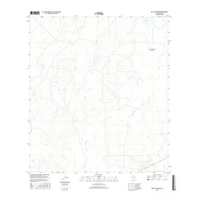
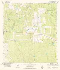
2016 Map of Biel Lake South
USGS Topo · Published 2016About this map
Biel Lake and a complex network of ephemeral waterways define this Webb County landscape, where the South Texas brush country is shaped by deep arroyos and winding creek beds. This 2016 survey captures the drainage patterns of the Arroyo de Charco Escondido and Black Cr, revealing a terrain marked by subtle elevation changes and cattle ranching infrastructure. The presence of Mesquitoso Cr and Torres Cr illustrates the vital role of seasonal water sources in this arid region. Aside from the primary Co RD, the map shows a sparse network of ranch roads and tracks that navigate the undulating ground between these drainages, offering a snapshot of contemporary land use in a region where large-scale ranching remains the primary geographic influence.
Find a feature on this map
6 named features on this map. Tap any name to fly to it.
Don’t see what you’re looking for? This feature index may not catch every label — zoom into the map to look around manually.
Map Details
Editions of this 2016 Biel Lake South Map
This is the sole edition of this map. No revisions or reprints were ever made.
Other maps of this area

1937 · Aguilete Creek
USGS Topo · 1:62,500

1956 · Becerra
USGS Topo · 1:62,500

1956 · Las Mujeres
USGS Topo · 1:62,500

1956 · Laredo
USGS Topo · 1:250,000

1968 · Mills Bennett
USGS Topo · 1:24,000

1968 · Mills Bennett NW
USGS Topo · 1:24,000
1973 · Biel Lake North
USGS Topo · 1:24,000
1974 · Biel Lake SE
USGS Topo · 1:24,000
1974 · Biel Lake South
USGS Topo · 1:24,000
1974 · Biel Lake NE
USGS Topo · 1:24,000