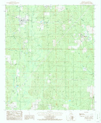
1986 Map of Bienville
USGS Topo · Published 1986About this map
Saline Bayou and its numerous tributaries, such as Hurricane Creek and Pea Vine Creek, dominate this portion of the Louisiana interior. The town of Bienville serves as the primary settlement, situated near an Old RR Grade that speaks to the region's earlier timber and transport era. Several smaller communities and rural crossings, including Liberty Hill, Cox Crossing, and New Friendship, are dispersed throughout the landscape, often positioned along the creeks that define the parish topography. The presence of Edwards Mill Creek and a Gravel Pit indicates a landscape shaped by local industry and natural resource extraction. This 1980s data highlights the persistence of small rural centers like Lucky and family-named landmarks like Crowson and Blume, which provide valuable points of reference for genealogists tracking family lands and historical property boundaries within the parish.
Find a feature on this map
22 named features on this map. Tap any name to fly to it.
Don’t see what you’re looking for? This feature index may not catch every label — zoom into the map to look around manually.
Map Details
Editions of this 1986 Bienville Map
This is the sole edition of this map. No revisions or reprints were ever made.
Other maps of this area

1947 · Goldonna
USGS Topo · 1:62,500

1947 · Ashland
USGS Topo · 1:62,500

1947 · Bienville
USGS Topo · 1:62,500

1948 · Jamestown
USGS Topo · 1:62,500

1949 · Jamestown
USGS Topo · 1:62,500

1949 · Bienville
USGS Topo · 1:62,500

1955 · Shreveport
USGS Topo · 1:250,000

1956 · Shreveport
USGS Topo · 1:250,000

1957 · Goldonna
USGS Topo · 1:62,500

1957 · Ashland
USGS Topo · 1:62,500