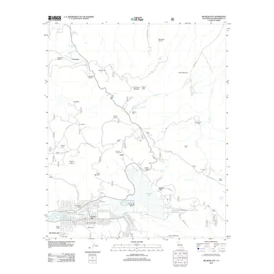
2012 Map of Big Bear City
USGS Topo · Published 2012About this map
Big Bear City sits at the western edge of Bear Valley, serving as a high-altitude hub for aviation and recreation. This 2012 survey shows the residential grid extending toward the Big Bear City Airport and the eastern tip of Big Bear Lake. To the east, the sprawling basin of Baldwin Lake dominates the landscape, surrounded by specialized terrain features like Nelson Ridge and Stocker Meadows.
Find a feature on this map
94 named features on this map. Tap any name to fly to it.
Don’t see what you’re looking for? This feature index may not catch every label — zoom into the map to look around manually.
Map Details
Editions of this 2012 Big Bear City Map
This is the sole edition of this map. No revisions or reprints were ever made.
Other maps of this area

1901 · Southern California Sheet No. 1
USGS Topo · 1:250,000

1902 · San Gorgonio
USGS Topo · 1:125,000

1904 · Southern California Sheet No. 1
USGS Topo · 1:250,000

1947 · Lucerne Valley
USGS Topo · 1:62,500

1949 · Lucerne Valley
USGS Topo · 1:62,500

1953 · San Bernardino
USGS Topo · 1:250,000

1954 · San Gorgonio Mountain
USGS Topo · 1:62,500

1955 · Old Woman Springs
USGS Topo · 1:62,500

1955 · Morongo Valley
USGS Topo · 1:62,500

1956 · San Bernardino
USGS Topo · 1:250,000