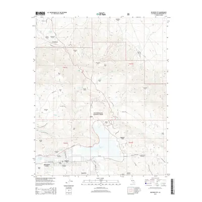
2015 Map of Big Bear City
USGS Topo · Published 2015About this map
San Bernardino National Forest dominates this high-altitude landscape, where the northern slopes of the San Bernardino Mountains transition toward the desert floor. The area is characterized by a network of seasonal springs and named flats, including Cushenbury Springs, Saragossa Spring, and Horsethief Flat. Historically significant terrain such as Holcomb Valley and Gold Mtn reflect the region's mining and ranching heritage. Near the southern edge, Big Bear City serves as a modern hub with the Big Bear City Airport and residential developments situated north of the Big Bear Lake shoreline. To the north, the settlement of Cushenbury sits at the mouth of Cushenbury Canyon. The Pacific Crest National Scenic Trail winds through the southern ridges, crossing Bertha Ridge and Nelson Ridge, providing a clear record of recreational corridors as they existed in the early twenty-first century.
Find a feature on this map
72 named features on this map. Tap any name to fly to it.
Don’t see what you’re looking for? This feature index may not catch every label — zoom into the map to look around manually.
Map Details
Editions of this 2015 Big Bear City Map
This is the sole edition of this map. No revisions or reprints were ever made.
Other maps of this area

1901 · Southern California Sheet No. 1
USGS Topo · 1:250,000

1902 · San Gorgonio
USGS Topo · 1:125,000

1904 · Southern California Sheet No. 1
USGS Topo · 1:250,000

1947 · Lucerne Valley
USGS Topo · 1:62,500

1949 · Lucerne Valley
USGS Topo · 1:62,500

1953 · San Bernardino
USGS Topo · 1:250,000

1954 · San Gorgonio Mountain
USGS Topo · 1:62,500

1955 · Old Woman Springs
USGS Topo · 1:62,500

1955 · Morongo Valley
USGS Topo · 1:62,500

1956 · San Bernardino
USGS Topo · 1:250,000