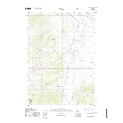
2020 Map of Big Black Dome
USGS Topo · Published 2020About this map
The Pioneer Mountains define this high-altitude landscape where the Challis National Forest and Sawtooth National Forest meet. Dominated by the prominent Big Black Dome and Pyramid Peak, the terrain is carved by steep drainages including Bellas Canyon, Broad Canyon, and Muldoon Canyon. A network of seasonal forest roads, such as the Copper Basin Loop Rd, provides access to remote recreational sites including Star Hope Creek Camping #1 and Star Hope Creek Camping #2. The hydrology of the area is centered around the E Fork Big Lost River and its numerous tributaries like Star Hope Cr and Muldoon Creek. High-mountain basins host significant water features like Bellas Lakes, Round Lake, and Clear Lake, illustrating the glaciated character of these central Idaho ranges near the border of Blaine and Custer counties.
Find a feature on this map
40 named features on this map. Tap any name to fly to it.
Don’t see what you’re looking for? This feature index may not catch every label — zoom into the map to look around manually.
Map Details
Editions of this 2020 Big Black Dome Map
This is the sole edition of this map. No revisions or reprints were ever made.
Other maps of this area

1895 · Hailey
USGS Topo · 1:125,000

1897 · Hailey
USGS Topo · 1:125,000

1935 · MacKay
USGS Topo · 1:96,000

1955 · Idaho Falls
USGS Topo · 1:250,000

1955 · Hailey
USGS Topo · 1:250,000

1958 · Idaho Falls
USGS Topo · 1:250,000

1959 · Hailey
USGS Topo · 1:250,000

1960 · Muldoon Canyon
USGS Topo · 1:62,500

1960 · Copper Basin
USGS Topo · 1:62,500

1962 · Hailey
USGS Topo · 1:250,000