
1955 Map of Hailey
USGS Topo · Published 1968About this map
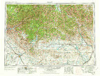
Mountain Home Air Force Base and its adjacent Gunnery Range anchor the southwestern corner of this mid-century landscape, illustrating the Cold War expansion of military infrastructure across the High Desert. Moving north, the terrain transitions into the Sawtooth Mountains and Pioneer Mountains, where a mining legacy is still evident through sites like the Triumph Mine and Silver Star Queens Mine. The map shows a network of reservoirs—including Arrowrock Reservoir and Magic Reservoir—critical for the agricultural development of the Camas Prairie. The Wood River Valley is well-defined, showing early resort life in Sun Valley alongside the established towns of Hailey and Bellevue. Transportation is dominated by the Union Pacific railroad lines, which served remote outposts like Tikura Station and Pagari Station before the full decline of rail-dependent commerce in the region.
Find a feature on this map
147 named features on this map. Tap any name to fly to it.
Don’t see what you’re looking for? This feature index may not catch every label — zoom into the map to look around manually.
Map Details
Editions of this 1955 Hailey Map
4 editions found
Other maps of this area

1891 · Bear Valley
USGS Topo · 1:125,000

1892 · Mountain Home
USGS Topo · 1:125,000

1892 · Boise
USGS Topo · 1:125,000

1892 · Bisuka
USGS Topo · 1:125,000

1892 · Camas Prairie
USGS Topo · 1:125,000

1893 · Mountain Home
USGS Topo · 1:125,000

1893 · Bear Valley
USGS Topo · 1:125,000

1893 · Camas Prairie
USGS Topo · 1:125,000

1894 · Bisuka
USGS Topo · 1:125,000

1894 · Squaw Creek
USGS Topo · 1:125,000