Old Maps of Elmore County, Idaho
Explore 547 old maps of Elmore County, spanning from 1891 to today. These high-resolution historic maps reveal how streets, neighborhoods, landmarks, and natural features evolved over time — perfect for genealogy, metal detecting, research, and local history exploration.
What you can do with these maps:
- See how Elmore County changed over time: Compare historical maps to modern-day views to trace roads, homesites, rail lines & more.
- View detailed metadata: Each map includes creators, publishers, year, scale, and archive source.
- Overlay maps with satellite & LiDAR: Visualize the past alongside modern tools to explore terrain & human change.
- Trusted historical sources: Maps sourced from the USGS, Library of Congress, and other archives.
- Access maps your way: View online, download high-res files, or order prints for personal or research use.
Start exploring old maps of Elmore County to uncover forgotten places, hidden landmarks, and the deep history beneath your feet.
Elmore County, ID maps
(547)- 1891 Map of Bear Valley, 1963 Print
 1891 Bear Valley1963 Print · USGSThe Idaho wilderness at the close of the nineteenth century is captured here in this early reconnaissance survey. Researchers can trace the pristine headwaters of the Middle Fork Salmon River and locate historic landmarks like Stanley Lake and Tyee Mtn.
 - 1892 Map of Mountain Home
 1892 Mountain Home1892 Print · USGSElmore County's high desert and foothills are captured in the late nineteenth century as the railroad begins to reshape the Idaho territory. Genealogists and historians can trace early transit routes through Mountain Home and Cleft or follow the Boise River near Smith Prairie.
 - 1892 Map of Bisuka
 1892 Bisuka1892 Print · USGSSouthern Idaho in the early 1890s was a land defined by the new Oregon Short Line Railroad and the deep cut of the canyon country. Researchers can trace early railroad stops at Bisuka and Kuna or locate the vital Boise Meridian reference at Initial Point.
 - 1892 Map of Camas Prairie
 1892 Camas Prairie1892 Print · USGSElmore County during the territorial era is documented here through its high plateaus and river systems just before the turn of the century. Genealogists and historians can trace early settlements like Pine Grove and the natural landmarks of Camas Prairie and the Snake River.
 - 1893 Map of Mountain Home
 1893 Mountain Home1893 Print · USGSElmore County during the frontier era of the late nineteenth century centers on the vital rail connection through the high desert. Genealogists and historians can trace the early layout of Mountain Home and Cleft along the Oregon Short Line Union Pacific Railroad.4 unique versions available
 - 1893 Map of Bear Valley
 1893 Bear Valley1893 Print · USGSCentral Idaho in the early 1890s was a wilderness of intersecting watersheds and mountain peaks long before modern infrastructure arrived. Trace the headwaters of the Salmon River and Payette River near Cape Horn and the Sawtooth Range.5 unique versions available
 - 1893 Map of Camas Prairie
 1893 Camas Prairie1893 Print · USGSElmore County was a land of high plateaus and river canyons in the years before major irrigation projects. Genealogists and researchers can trace the early layout of Little Camas Prairie and High Prairie, or locate the 1890s settlement at Pine Grove.4 unique versions available
 - 1894 Map of Bisuka
 1894 Bisuka1894 Print · USGSSouthern Idaho in the 1890s was a landscape defined by the arrival of the rails and the deep canyon of the Snake River. Genealogists and historians can trace the early path of the Oregon Short Line Railroad through Kuna and locate the vital Initial Point survey marker.6 unique versions available
 - 1894 Map of Idaho Basin
 1894 Idaho Basin1894 Print · USGSThe Idaho Basin at the height of the mining era is revealed here through its network of camps and mountain trails. Genealogists and historians can trace early settlements like Pioneerville, Idaho City, and Placerville alongside landmarks like Halfway House.7 unique versions available
 - 1894 Map of Rocky Bar
 1894 Rocky Bar1894 Print · USGSElmore County was a landscape of high-altitude mining camps and river forks in the 1890s. Genealogists and researchers can trace the early layout of remote mountain outposts like Atlanta and Rocky Bar or the banks of the South Fork Boise River.5 unique versions available
 - 1900 Map of Sawtooth
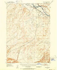
 1900 Sawtooth1900 Print · USGSThe high Idaho backcountry was a hub of hard-rock mining and remote outposts during the late 1890s. Genealogists and historians can trace the foundations of silver-era camps like Carrietown and Vienna or locate industrial sites like the Silver King Mine and Columbia Mill.4 unique versions available
 - 1946 Map of Mouth of Bruneau, 1967 Print
 1946 Mouth of Bruneau1967 Print · USGSThe confluence of the Snake and Bruneau rivers in the late 1940s reveals a landscape shaped by overland migration and canyon ranching. Genealogists and historians can trace the Emigrant Trail and locate family landmarks like the Roy Johnson Ranch or Halls Ferry.3 unique versions available
 - 1947 Map of Grand View, 1952 Print
 1947 Grand View1952 Print · USGSOwyhee County ranching and irrigation are captured here at the end of the 1940s, centered on the riverfront settlement of Grand View. Researchers can trace early family holdings like Whitson Ranch or find the Cem and Landing Strip near the banks of the Snake River.2 unique versions available
 - 1947 Map of Bruneau, 1952 Print
 1947 Bruneau1952 Print · USGSThe confluence of the Snake and Bruneau Rivers in the late 1940s reveals a rugged landscape defined by pioneer history and modern irrigation. Researchers can trace the Emigrant Trail to the Halls Ferry (Site) and locate landmarks like the Little Valley Sch (Aban'd) and ancient Petroglyphs.2 unique versions available
 - 1947 Map of Indian Cove, 1963 Print
 1947 Indian Cove1963 Print · USGSSouthern Idaho's high desert reveals its transit history in the 1940s as the Old Oregon Trail and Union Pacific traverse the Snake River canyon. Trace the development of the region through landmarks like Chalk Spur, the Indian Cove Bridge, and Sparlin Island.4 unique versions available
 - 1947 Map of Grand View, 1966 Print
 1947 Grand View1966 Print · USGSOwyhee County's high desert meets the river's edge in the late 1940s, revealing an era of expanding irrigation and ranching. Genealogists and historians can trace family land at Whitson Ranch, locate the Cem, or study the early engineering of the Low Line Canal.3 unique versions available
 - 1947 Map of Hammett, 1966 Print
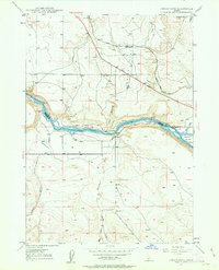
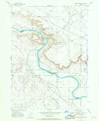
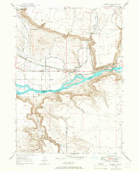 1947 Hammett1966 Print · USGSThe Snake River corridor in Idaho comes alive in the late 1940s, showing the intersection of pioneer paths and modern irrigation. Trace the Old Oregon Trail as it passes through Hammett, and locate the Medbury Ferry and McGinness Ranch along the river.2 unique versions available
 - 1947 Map of Sand Dunes, 1966 Print
 1947 Sand Dunes1966 Print · USGSOwyhee County's high desert meets the river in the late 1940s, a landscape defined by the migrating Sand Dunes and the powerful Snake River. Genealogists and historians can trace the routes of the Emigrant Trail and the Old Mountain Home Trail past landmarks like Barber Cabin.4 unique versions available
 - 1947 Map of Glenns Ferry, 1968 Print
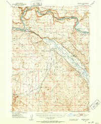
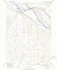
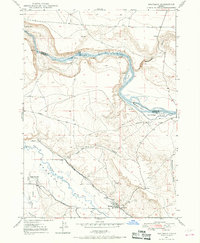
 1947 Glenns Ferry1968 Print · USGSGlenns Ferry and the Snake River valley are captured in the late 1940s, highlighting a landscape defined by historic emigrant paths and rail infrastructure. You can trace the route of the Oregon Trail as it meets the Snake River at Three Island Crossing.2 unique versions available
 - 1947 Map of Pasadena Valley, 1968 Print
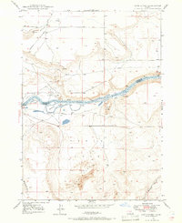
 1947 Pasadena Valley1968 Print · USGSElmore County's river-driven landscape is captured here in the late 1940s as irrigation and historical trails converge along the Snake River. Researchers can trace the Old Oregon Trail past the Pilgrim Stage Sta Historic Site and the Pasadena Valley Sch.2 unique versions available
 - 1947 Map of Bruneau, 1968 Print
 1947 Bruneau1968 Print · USGSThe Owyhee County desert meets the river canyons in the late 1940s, where pioneer history and irrigation agriculture overlap. Trace the historic Emigrant Trail down to the Emigrant Crossing and find the location of the Little Valley Sch (Aban'd).3 unique versions available
 - 1947 Map of Jackass Butte, 1971 Print
 1947 Jackass Butte1971 Print · USGSThe Snake River canyon and the high desert bluffs of Owyhee County come alive in this late 1940s survey. Researchers can trace the path of the historic Emigrant Trail and locate local landmarks like Brooks Ranch, Birch Creek Sch, and Rabbit Springs.2 unique versions available
 - 1947 Map of Dorsey Butte, 1979 Print
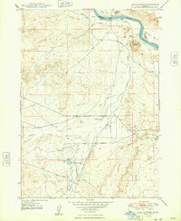
 1947 Dorsey Butte1979 Print · USGSElmore County's high desert landscape is captured here in the late 1940s as irrigation projects transformed the arid basin. Researchers can trace the local water economy through the High Line Canal and locate the historic Hayland Sch near Chattin Hill.
 - 1948 Map of Castle Butte
 1948 Castle Butte1948 Print · USGSOwyhee County ranching and transit corridors are captured here in the late 1940s as the high plateau supported isolated homesteads and water projects. Researchers can trace the historic Emigrant Trail and locate local landmarks such as the Castle Creek Sch, Morgan Place, and the site of Clarks Ferry.2 unique versions available
 - 1948 Map of Pasadena Valley
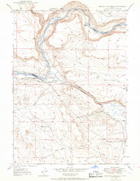
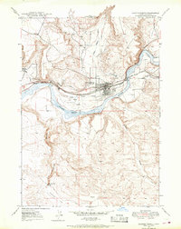
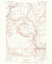
 1948 Pasadena Valley1948 Print · USGSThe Snake River canyon in the late 1940s reveals a landscape defined by vital irrigation works and transcontinental rail. Trace the historic Pilgrim Stage Sta Historic Site and follow the intricate King Hill Main Canal as it waters Pasadena Valley.
Showing maps 1-25 of 547
Top cities of Elmore County
Frequently asked questions
- What are the different types of historical maps available for Elmore County?
- What is the oldest map of Elmore County?
- Where can I purchase historical maps of Elmore County for my home or office?
- Where can I download high-res historical maps of Elmore County?
- Are there historical topographic maps available for Elmore County?
- Is there historical aerial imagery available for Elmore County?
- Where are historical maps of Elmore County sourced from?