
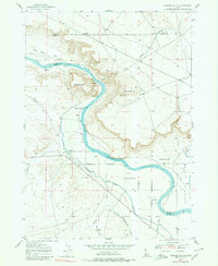
1947 Map of Jackass Butte
USGS Topo · Published 1971About this map
The Snake River carves a deep, winding path through the high desert of southwest Idaho, defining the boundary between Ada and Owyhee counties. This post-war survey details a landscape where historic overland travel meets early 20th-century irrigation engineering. The Emigrant Trail is clearly traced as it skirts the southern bluffs above the river, passing near landmarks like Jackass Butte and Black Butte.
Find a feature on this map
22 named features on this map. Tap any name to fly to it.
Don’t see what you’re looking for? This feature index may not catch every label — zoom into the map to look around manually.
Map Details
Editions of this 1947 Jackass Butte Map
2 editions found
Other maps of this area

1892 · Bisuka
USGS Topo · 1:125,000

1894 · Bisuka
USGS Topo · 1:125,000

1947 · Grand View
USGS Topo · 1:62,500

1947 · Grand View
USGS Topo · 1:24,000

1947 · Wild Horse Butte
USGS Topo · 1:24,000

1947 · Vinson Wash
USGS Topo · 1:24,000

1947 · Dorsey Butte
USGS Topo · 1:24,000

1948 · Castle Butte
USGS Topo · 1:24,000

1948 · Vinson Wash
USGS Topo · 1:24,000

1948 · Big Foot Butte
USGS Topo · 1:24,000