
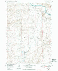
1948 Map of Castle Butte
USGS Topo · Published 1948About this map
The Emigrant Trail traverses the high desert plateau of Henderson Flats in this mid-century survey of Owyhee County. This arid landscape is defined by its water engineering, where a complex system of a Log Dam, a Flume, and a Ditch diverts water from Castle Creek to support isolated ranching outposts like Morgan Place and Foremans Res. The presence of the Castle Creek Sch near the creek's southern reach suggests a small but established rural community at the time of the survey.
Find a feature on this map
31 named features on this map. Tap any name to fly to it.
Don’t see what you’re looking for? This feature index may not catch every label — zoom into the map to look around manually.
Map Details
Editions of this 1948 Castle Butte Map
2 editions found
Other maps of this area

1892 · Bisuka
USGS Topo · 1:125,000

1894 · Bisuka
USGS Topo · 1:125,000

1947 · Grand View
USGS Topo · 1:62,500

1947 · Jackass Butte
USGS Topo · 1:24,000

1947 · Wild Horse Butte
USGS Topo · 1:24,000

1947 · Vinson Wash
USGS Topo · 1:24,000

1948 · Vinson Wash
USGS Topo · 1:24,000

1948 · Big Foot Butte
USGS Topo · 1:24,000

1948 · Wild Horse Butte
USGS Topo · 1:24,000

1948 · Jackass Butte
USGS Topo · 1:24,000