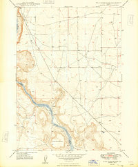
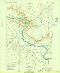
1948 Map of Wild Horse Butte
USGS Topo · Published 1948About this map
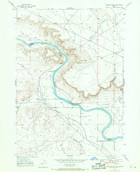
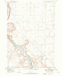
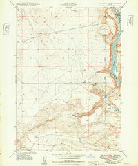
The Snake River carves a deep canyon through this landscape, serving as the primary boundary between Ada Co and Owyhee Co in southern Idaho. Mapped in the late 1940s, the terrain is defined by dramatic elevation shifts from the riverbed up to the surrounding plateaus. Wild Horse Butte stands as a prominent landmark on the eastern bank, rising above Big Foot Bar and the southern bend of the river.
Find a feature on this map
9 named features on this map. Tap any name to fly to it.
Don’t see what you’re looking for? This feature index may not catch every label — zoom into the map to look around manually.
Map Details
Editions of this 1948 Wild Horse Butte Map
This is the sole edition of this map. No revisions or reprints were ever made.
Other maps of this area

1892 · Bisuka
USGS Topo · 1:125,000

1894 · Bisuka
USGS Topo · 1:125,000
1947 · Jackass Butte
USGS Topo · 1:24,000
1947 · Wild Horse Butte
USGS Topo · 1:24,000
1948 · Castle Butte
USGS Topo · 1:24,000
1948 · Big Foot Butte
USGS Topo · 1:24,000
1948 · Jackass Butte
USGS Topo · 1:24,000
1948 · Big Foot Butte
USGS Topo · 1:62,500
1948 · Sinker Butte
USGS Topo · 1:24,000
1949 · Sinker Butte
USGS Topo · 1:24,000