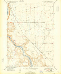
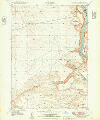
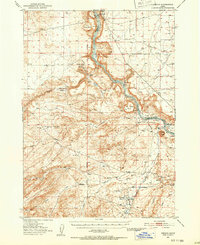
1948 Map of Sinker Butte
USGS Topo · Published 1966About this map
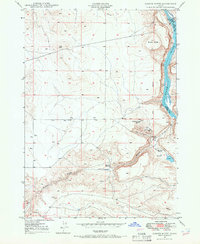
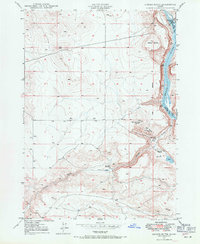
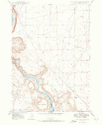
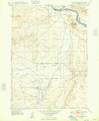
The Emigrant Trail carves a path through this high desert terrain in Owyhee County, providing a stark reminder of the overland journey across the Idaho territory. This survey identifies the location of the Otter Massacre Site and Jacob Reuben Graves, marking significant and somber points of local history along the northern bank of Sinker Creek. The landscape is dominated by volcanic features like Sinker Butte and Sinker Creek Butte, while the Snake River forms the eastern boundary, serving as a hub for early infrastructure. Near the Swan Falls rapids, a Power Plant and a nearby Ferry signify the transition from natural barriers to harnessed resources. Ranching outposts such as Montini Ranch and Gabica Ranch are scattered near the few available water sources, including several named Well sites and a Spring.
Find a feature on this map
17 named features on this map. Tap any name to fly to it.
Don’t see what you’re looking for? This feature index may not catch every label — zoom into the map to look around manually.
Map Details
Editions of this 1948 Sinker Butte Map
2 editions found
Other maps of this area

1892 · Bisuka
USGS Topo · 1:125,000

1892 · Silver City
USGS Topo · 1:125,000

1894 · Bisuka
USGS Topo · 1:125,000

1894 · Silver City
USGS Topo · 1:125,000

1898 · Silver City
USGS Topo · 1:125,000
1947 · Wild Horse Butte
USGS Topo · 1:24,000
1948 · Castle Butte
USGS Topo · 1:24,000
1948 · Wild Horse Butte
USGS Topo · 1:24,000
1949 · Sinker Butte
USGS Topo · 1:24,000
1949 · Oreana
USGS Topo · 1:62,500