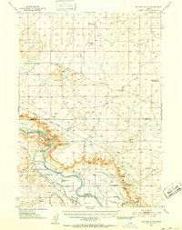
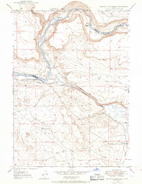
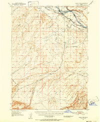
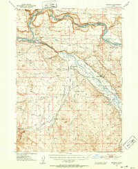
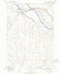
1948 Map of Big Foot Butte
USGS Topo · Published 1952About this map
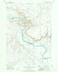
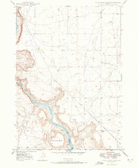
The Snake River carves a dramatic canyon through this high desert landscape, defining the intersection of Ada, Elmore, and Owyhee counties. Irrigation infrastructure dominates the lowlands at Chattin Flat, where the Low Line Canal, Middle Line Canal, and High Line Canal distribute water across the volcanic soil. This 1940s survey captures a transition in desert navigation, showing the historic Emigrant Trail cutting across the northern plateaus near Big Foot Butte while a modern Landing Strip appears further south.
Find a feature on this map
32 named features on this map. Tap any name to fly to it.
Don’t see what you’re looking for? This feature index may not catch every label — zoom into the map to look around manually.
Map Details
Editions of this 1948 Big Foot Butte Map
This is the sole edition of this map. No revisions or reprints were ever made.
Other maps of this area

1892 · Mountain Home
USGS Topo · 1:125,000

1892 · Bisuka
USGS Topo · 1:125,000

1893 · Mountain Home
USGS Topo · 1:125,000

1894 · Bisuka
USGS Topo · 1:125,000
1946 · Mouth of Bruneau
USGS Topo · 1:24,000
1947 · Grand View
USGS Topo · 1:62,500
1947 · Bruneau
USGS Topo · 1:62,500
1947 · Grand View
USGS Topo · 1:24,000
1947 · Jackass Butte
USGS Topo · 1:24,000
1947 · Wild Horse Butte
USGS Topo · 1:24,000