
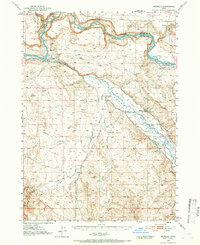
1947 Map of Bruneau
USGS Topo · Published 1952About this map
The confluence of the Snake River and the Bruneau River anchors this Idaho landscape, where high-desert terrain meets the essential irrigation infrastructure of the mid-20th century. Traces of early transit and settlement are evident along the riverbanks, including the Emigrant Trail and an Emigrant Crossing, alongside the historic Halls Ferry (Site). The map reveals a transition from these early pioneer routes to established ranching and agriculture, supported by the Grand View Irrigation Canal and Buckaroo Ditch.
Find a feature on this map
37 named features on this map. Tap any name to fly to it.
Don’t see what you’re looking for? This feature index may not catch every label — zoom into the map to look around manually.
Map Details
Editions of this 1947 Bruneau Map
2 editions found
Other maps of this area

1892 · Mountain Home
USGS Topo · 1:125,000

1892 · Bisuka
USGS Topo · 1:125,000

1893 · Mountain Home
USGS Topo · 1:125,000

1894 · Bisuka
USGS Topo · 1:125,000

1946 · Mouth of Bruneau
USGS Topo · 1:24,000

1947 · Little Valley
USGS Topo · 1:24,000

1947 · Grand View
USGS Topo · 1:62,500

1947 · Grand View
USGS Topo · 1:24,000

1947 · Sand Dunes
USGS Topo · 1:24,000

1947 · Bruneau
USGS Topo · 1:24,000