
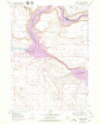
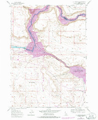
1946 Map of Mouth of Bruneau
USGS Topo · Published 1967About this map
Snake River and Bruneau River converge in this high-desert canyon landscape, where the historic Emigrant Trail traverses the benchlands south of the water. The survey, compiled from 1946 aerial photography, captures the intersection of early Western migration routes and mid-century ranching life. Key landmarks such as Halls Ferry and the Roy Johnson Ranch indicate the importance of river crossings and irrigation in this arid environment. The presence of Petroglyphs near the mouth of the Bruneau suggests a deep human history in these canyons, while features like the Gaging Sta and an Artesian Well reflect the ongoing efforts to manage water resources in the Little Valley region. Below the high bluffs, the river drops through Ninefoot Rapids, a notable obstacle for early navigation along the Elmore and Owyhee county border.
Find a feature on this map
15 named features on this map. Tap any name to fly to it.
Don’t see what you’re looking for? This feature index may not catch every label — zoom into the map to look around manually.
Map Details
Editions of this 1946 Mouth of Bruneau Map
3 editions found
Other maps of this area

1892 · Mountain Home
USGS Topo · 1:125,000

1892 · Bisuka
USGS Topo · 1:125,000

1893 · Mountain Home
USGS Topo · 1:125,000

1894 · Bisuka
USGS Topo · 1:125,000

1947 · Little Valley
USGS Topo · 1:24,000

1947 · Grand View
USGS Topo · 1:62,500

1947 · Bruneau
USGS Topo · 1:62,500

1947 · Grand View
USGS Topo · 1:24,000

1947 · Bruneau
USGS Topo · 1:24,000

1947 · Sugar Valley
USGS Topo · 1:24,000