
1947 Map of Sugar Valley
USGS Topo · Published 1969About this map
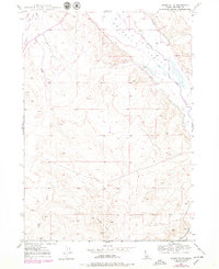
The Bruneau River carves through the Idaho landscape in this 1940s topographic study, showing a river valley defined by its irrigation infrastructure and early roads. A network of water management features, including the Buckaroo Ditch, South Side Canal, and Hot Spring Canal, traces the lowlands, supporting the agricultural life of the valley. A singular Artesian Well and a Cem provide important markers of human settlement and local history near the riverbanks.
Find a feature on this map
12 named features on this map. Tap any name to fly to it.
Don’t see what you’re looking for? This feature index may not catch every label — zoom into the map to look around manually.
Map Details
Editions of this 1947 Sugar Valley Map
2 editions found
Other maps of this area

1946 · Mouth of Bruneau
USGS Topo · 1:24,000

1947 · Little Valley
USGS Topo · 1:24,000

1947 · Bruneau
USGS Topo · 1:62,500

1947 · Sand Dunes
USGS Topo · 1:24,000

1947 · Bruneau
USGS Topo · 1:24,000

1947 · Hot Spring
USGS Topo · 1:24,000

1948 · Sand Dunes
USGS Topo · 1:24,000
1948 · Little Valley
USGS Topo · 1:24,000

1948 · Sugar Valley
USGS Topo · 1:24,000
1948 · Bruneau
USGS Topo · 1:24,000