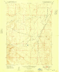
1948 Map of Little Valley
USGS Topo · Published 1948About this map
Little Valley Creek and its surrounding drainage systems define this high-desert landscape in Owyhee County, surveyed in the late 1940s. The map illustrates a reliance on groundwater in this arid region, marked by several instances of an Artesian Well providing essential resources for the local cattle industry or early settlers. Human activity is concentrated along the arterial Shoofly Road, which cuts diagonally across the terrain toward Shoofly Gulch.
Find a feature on this map
9 named features on this map. Tap any name to fly to it.
Don’t see what you’re looking for? This feature index may not catch every label — zoom into the map to look around manually.
Map Details
Editions of this 1948 Little Valley Map
This is the sole edition of this map. No revisions or reprints were ever made.
Other maps of this area

1946 · Mouth of Bruneau
USGS Topo · 1:24,000

1947 · Little Valley
USGS Topo · 1:24,000

1947 · Grand View
USGS Topo · 1:62,500

1947 · Bruneau
USGS Topo · 1:62,500

1947 · Grand View
USGS Topo · 1:24,000

1947 · Bruneau
USGS Topo · 1:24,000

1947 · Sugar Valley
USGS Topo · 1:24,000

1947 · Chalk Hills
USGS Topo · 1:24,000
1948 · Grand View
USGS Topo · 1:24,000
1948 · Chalk Hills
USGS Topo · 1:24,000