
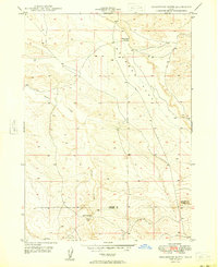
1948 Map of Pasadena Valley
USGS Topo · Published 1948About this map
The Snake River carves a deep path through this 1940s Idaho landscape, defining the agricultural and transport corridor of the region. The map details a sophisticated irrigation network essential for desert farming, featuring the King Hill Main Canal, the King Hill Lateral, and various flumes and siphons that draw water toward the fertile Pasadena Valley. High basalt plateaus like Black Mesa and Jolley Flat overlook the river canyon, while the Oregon Short Line (Union Pacific) railroad follows the river's northern bank. Local life is centered around the Pasadena Valley Sch, and the historical significance of the area is noted at the Pilgrim Stage Sta Historic Site near Big Pilgrim Gulch. This survey captures the mid-century infrastructure of Elmore County before modern expansion, from the springs at Bancroft Springs to the volcanic profile of the Sugar Bowl.
Find a feature on this map
20 named features on this map. Tap any name to fly to it.
Don’t see what you’re looking for? This feature index may not catch every label — zoom into the map to look around manually.
Map Details
Editions of this 1948 Pasadena Valley Map
This is the sole edition of this map. No revisions or reprints were ever made.
Other maps of this area

1892 · Camas Prairie
USGS Topo · 1:125,000

1893 · Camas Prairie
USGS Topo · 1:125,000

1947 · Glenns Ferry
USGS Topo · 1:24,000

1947 · Pasadena Valley
USGS Topo · 1:24,000

1948 · Glenns Ferry
USGS Topo · 1:24,000

1948 · Twentymile Butte
USGS Topo · 1:24,000

1948 · Glenns Ferry
USGS Topo · 1:62,500

1948 · Ticeska
USGS Topo · 1:24,000

1948 · Grindstone Butte
USGS Topo · 1:24,000
1949 · Grindstone Butte
USGS Topo · 1:24,000