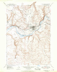
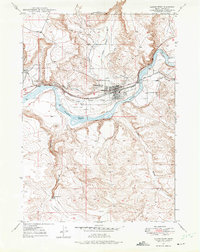
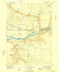
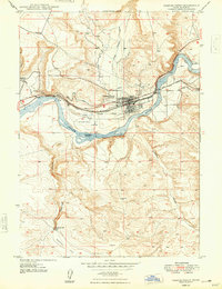
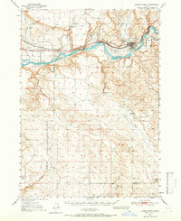
1947 Map of Glenns Ferry
USGS Topo · Published 1968About this map
Glenns Ferry serves as the focal point of this mid-century landscape, positioned where the Union Pacific railroad and the historic Oregon Trail converge along the northern bank of the Snake River. The map highlights the town's geographic importance as a transit hub, featuring the famous Three Island Crossing, a vital river passage for early emigrants. The local economy and infrastructure are clearly defined by the King Hill Main Canal and the Landing Field, alongside smaller landmarks like the Slick Bridge and a Cem northwest of the main settlement.
Find a feature on this map
18 named features on this map. Tap any name to fly to it.
Don’t see what you’re looking for? This feature index may not catch every label — zoom into the map to look around manually.
Map Details
Editions of this 1947 Glenns Ferry Map
2 editions found
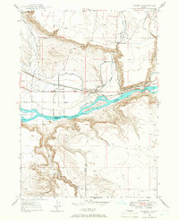
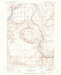
Other maps of this area

1892 · Camas Prairie
USGS Topo · 1:125,000

1893 · Camas Prairie
USGS Topo · 1:125,000
1947 · Hammett
USGS Topo · 1:24,000
1947 · Pasadena Valley
USGS Topo · 1:24,000

1948 · Pasadena Valley
USGS Topo · 1:24,000
1948 · Hammett
USGS Topo · 1:24,000
1948 · Glenns Ferry
USGS Topo · 1:24,000

1948 · Twentymile Butte
USGS Topo · 1:24,000
1948 · Glenns Ferry
USGS Topo · 1:62,500

1948 · Grindstone Butte
USGS Topo · 1:24,000