1950s Maps of Elmore County, Idaho
Explore 22 historic maps of Elmore County from the 1950s. These maps offer a rare glimpse into what life looked like during the 1950s — showing old roads, neighborhoods, homes, and landmarks that have changed or disappeared over time.
Whether you're researching your family's past, planning a metal detecting trip, or studying how Elmore County's landscape evolved across the 1950s, these high-resolution maps are a powerful tool for exploring the history of this region.
- Focus on a specific era: All maps on this page are from the 1950s, giving you a focused view of this time period.
- See what’s changed: Compare century-old streets, trails, and buildings to today's modern landscape using overlays and satellite layers.
- Research with precision: Use these maps for genealogy, historical research, land use analysis, or educational projects.
- View, download, or print: Maps are fully viewable online in high resolution, and can be downloaded or printed for your own records.
Start exploring Elmore County's history through authentic maps from the 1950s. This is your window into the past.
Elmore County, ID maps
(22)- 1950 Map of Indian Butte
 1950 Indian Butte1950 Print · USGSThe high Idaho desert south of the Snake River is captured here in the mid-century, defined by its role as a sprawling Aerial Gunnery Range. Researchers can trace old routes like the Castleford Road and explore landmarks like Indian Butte.
 - 1951 Map of Glenns Ferry
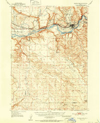 1951 Glenns Ferry1951 Print · USGSThe Snake River valley in the early fifties was a vital corridor of rail and river history. Genealogists and historians can trace the legacy of the Oregon Short Line and locate landmarks like Three Island Crossing and McGinness Ranch.
 - 1955 Map of Jordan Valley, 1963 Print
 1955 Jordan Valley1963 Print · USGSThe high desert of Malheur County comes alive in the mid-1950s, showing the isolated ranching outposts and deep canyons along the Idaho border. Researchers can trace the remote reaches of the Owyhee River, the cattle town of Jordan Valley, and mining landmarks like War Eagle Mountain.3 unique versions available
 - 1955 Map of Twin Falls, 1963 Print
 1955 Twin Falls1963 Print · USGSThe Magic Valley flourished in the mid-1950s as a sophisticated network of irrigation and rail lines connected high-desert outposts. Researchers can trace the engineering of the Milner-Gooding Canal, the remote Murphy Hot Springs, and the Union Pacific rail network.3 unique versions available
 - 1955 Map of Hailey, 1968 Print
 1955 Hailey1968 Print · USGSCentral Idaho in the mid-fifties reveals a landscape transitioning from deep-rooted silver mining to a burgeoning outdoor economy. Researchers can trace the legacy of the Union Pacific line, the remote Triumph Mine, and original airfield layouts at Mountain Home Air Force Base.4 unique versions available
 - 1955 Map of Boise, 1977 Print
 1955 Boise1977 Print · USGSThe Treasure Valley and Owyhee uplands are shown in detail during the mid-fifties, capturing the region's transition into a major agricultural and urban hub. Researchers can trace the Union Pacific line through Nampa, explore the volcanic Jordan Craters, or locate the historic mining district of Silver City.
 - 1956 Map of Mountain Home South, 1957 Print
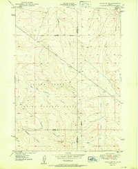
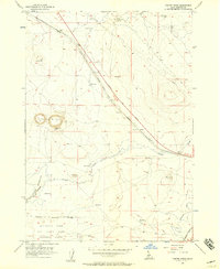
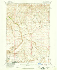
 1956 Mountain Home South1957 Print · USGSElmore County's high desert landscape comes into focus during the mid-fifties, revealing a vital junction for Idaho's rail and road networks. Trace the historical layers of the Old Oregon Trail alongside older routes like the Freight Trail and the Old Lamberton Trail.3 unique versions available
 - 1956 Map of Cinder Cone Butte, 1957 Print
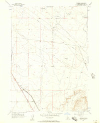
 1956 Cinder Cone Butte1957 Print · USGSThe high desert of Elmore County in the mid-1950s served as a critical training ground for defense and local mining. You can trace the boundaries of the Mountain Home Air Force Base Gunnery Range and locate landmarks like Cinder Cone Butte and Fraser Reservoir.2 unique versions available
 - 1956 Map of Crater Rings, 1957 Print
 1956 Crater Rings1957 Print · USGSElmore County's volcanic landscape is captured here in the mid-1950s, showing the intersection of pioneer history and modern military activity. You can trace the Old Oregon Trail Highway alongside the Union Pacific tracks and the Mountain Home Air Force Base Gunnery Range.3 unique versions available
 - 1956 Map of Reverse, 1957 Print
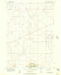
 1956 Reverse1957 Print · USGSElmore County's high desert landscape comes into focus during the mid-fifties, centered on the transit corridor at Reverse. Trace the historic path of the Old Oregon Trail Highway alongside the Union Pacific rail line and landmarks like Eureka Cave.3 unique versions available
 - 1956 Map of Mountain Home North, 1957 Print
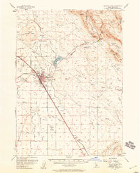
 1956 Mountain Home North1957 Print · USGSElmore County's development shines in the mid-1950s as a vital transportation and irrigation hub. You can trace the historic Old Oregon Trail Road alongside the Union Pacific Railroad and identify local landmarks like Mtn View Cemetery.3 unique versions available
 - 1956 Map of Crater Rings SW, 1957 Print
 1956 Crater Rings SW1957 Print · USGSMilitary aviation and tactical training grounds define this Idaho desert landscape in the mid-fifties. Researchers can trace the development of Mountain Home Air Force Base and its Gunnery Range alongside a remote Jeep Trail and the C J Strike Res.3 unique versions available
 - 1956 Map of Mountain Home, 1958 Print
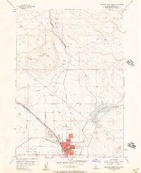
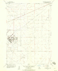
 1956 Mountain Home1958 Print · USGSMountain Home was a critical Idaho transport hub in the mid-fifties, where the railroad met historic western trails. Genealogists and local historians can trace family plots at Elmore Memorial Cemetery or locate the Oregon Trail Historical Marker near Teapot Basin.2 unique versions available
 - 1956 Map of Crater Rings SE, 1958 Print
 1956 Crater Rings SE1958 Print · USGSElmore County's high desert underwent a significant transformation in the mid-fifties as military operations expanded. Researchers can trace the base street plan along Main Ave, the path of the Military Railroad, and the Old Lamberton Canal.3 unique versions available
 - 1957 Map of Jordan Valley
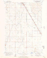
 1957 Jordan Valley1957 Print · USGSThe high-desert borderlands of Oregon and Idaho appear in the mid-fifties as a world of remote cattle ranches and mining claims. Researchers can trace historic family-named locations like Bowden Ranch and Riddle alongside the South Mountain Mining Company.
 - 1957 Map of Challis, 1964 Print
 1957 Challis1964 Print · USGSCentral Idaho in the late fifties and early sixties remains a territory of remote mining camps and high-mountain ranger stations. Trace historic mining operations like the Lucky Boy Mine or locate isolated homesteads including Robinson Bar Ranch and Allison Ranch.3 unique versions available
 - 1958 Map of Twin Falls
 1958 Twin Falls1958 Print · USGSThe Magic Valley and Snake River Plain are captured here in the late fifties, showcasing a region defined by transformative irrigation projects and desert military ranges. Researchers can trace the Union Pacific rail lines and locate small outlying settlements like Wickahoney, Rogerson, and Hollister.2 unique versions available
 - 1958 Map of Boise
 1958 Boise1958 Print · USGSThe Treasure Valley and Snake River Plain come alive in the mid-fifties as the rail-and-river economy transitions into a modern agricultural hub. Trace the Union Pacific lines through Nampa or locate remote landmarks like Initial Point and the Rockville settlement.2 unique versions available
 - 1958 Map of Jordan Valley
 1958 Jordan Valley1958 Print · USGSSoutheast Oregon and Southwest Idaho are documented here during the mid-fifties, showing a landscape of remote cattle ranches and volcanic badlands. Genealogists and historians can trace family operations like the Bowden Ranch or locate the Pleasant Valley School and the South Mountain Mining Company.2 unique versions available
 - 1958 Map of Bennett Mtn, 1959 Print
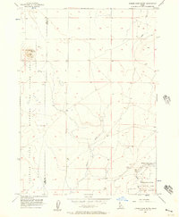
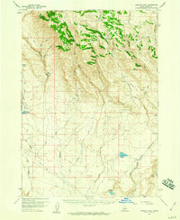 1958 Bennett Mtn1959 Print · USGSElmore County ranch lands and high desert peaks are captured here in the late fifties, showing a landscape defined by water and wilderness. Genealogists and researchers can locate remote outposts like Berry Ranch or trace historical travel routes through Emigrant Crossing and Stone Crossing.2 unique versions available
 - 1958 Map of King Hill, 1960 Print
 1958 King Hill1960 Print · USGSKing Hill and the southern slopes of the Mount Bennett Hills are captured here in the late fifties, showcasing a landscape shaped by the railroad and irrigation. Researchers can trace the Union Pacific line and locate local landmarks like the Cem, Indian Writing Water Hole, and Walker Reservoir.2 unique versions available
 - 1959 Map of Hailey
 1959 Hailey1959 Print · USGSThe Sawtooth range and high desert plains of Southern Idaho are captured here during a period of mining and military growth. Genealogists and historians can locate mining sites like Triumph Mine, early settlements such as Idaho City, and the Mountain Home Air Force Base.2 unique versions available
End of results
Showing maps 1-22 of 22
Top cities of Elmore County
Frequently asked questions
- What are the different types of historical maps available for Elmore County?
- What is the oldest map of Elmore County?
- Where can I purchase historical maps of Elmore County for my home or office?
- Where can I download high-res historical maps of Elmore County?
- Are there historical topographic maps available for Elmore County?
- Is there historical aerial imagery available for Elmore County?
- Where are historical maps of Elmore County sourced from?