1990s Maps of Elmore County, Idaho
Explore 35 historic maps of Elmore County from the 1990s. These maps offer a rare glimpse into what life looked like during the 1990s — showing old roads, neighborhoods, homes, and landmarks that have changed or disappeared over time.
Whether you're researching your family's past, planning a metal detecting trip, or studying how Elmore County's landscape evolved across the 1990s, these high-resolution maps are a powerful tool for exploring the history of this region.
- Focus on a specific era: All maps on this page are from the 1990s, giving you a focused view of this time period.
- See what’s changed: Compare century-old streets, trails, and buildings to today's modern landscape using overlays and satellite layers.
- Research with precision: Use these maps for genealogy, historical research, land use analysis, or educational projects.
- View, download, or print: Maps are fully viewable online in high resolution, and can be downloaded or printed for your own records.
Start exploring Elmore County's history through authentic maps from the 1990s. This is your window into the past.
Elmore County, ID maps
(35)- 1990 Map of Triangle
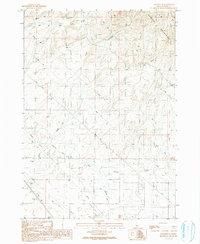
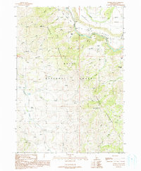
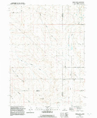
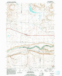
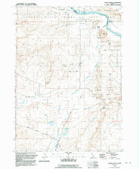
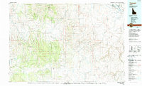 1990 Triangle1990 Print · USGSThe Owyhee high desert is captured here in the late twentieth century, showing a vast network of canyonlands and isolated settlements. Researchers can trace historic mining activity at Black Warrior Mine and the remote outpost of Triangle amidst the Owyhee Mountains.
 - 1990 Map of Long Tom Reservoir, 1991 Print
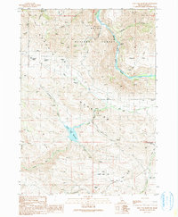 1990 Long Tom Reservoir1991 Print · USGSElmore County's high-country terrain is captured in this late-twentieth-century study of the Boise National Forest and the Danskin Mountains. Genealogists and researchers can locate family-named landmarks like McGuire Spring, Timmons Field, and the Long Tom Ranch.
 - 1990 Map of Syrup Creek, 1991 Print
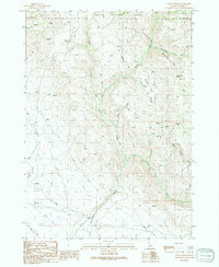 1990 Syrup Creek1991 Print · USGSThe Danskin Mountains and Boise National Forest are shown here in the 1990s before modern development. Trace rugged resource-extraction sites like Prospects and water infrastructure such as the Gaging Sta and Water Tank.
 - 1990 Map of Mayfield SW, 1991 Print
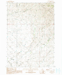
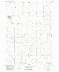
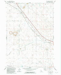
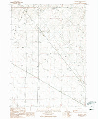 1990 Mayfield SW1991 Print · USGSThe high desert plateau of Elmore County is captured in the early nineties, showing a landscape defined by utility infrastructure and historical transit routes. Researchers can trace the path of an Old Railroad Grade and locate features like the Gravel Pit and seasonal Soles Rest Creek.
 - 1990 Map of Mayfield SE, 1991 Print
 1990 Mayfield SE1991 Print · USGSElmore County's high desert and foothills are captured here in the early nineties, showing a landscape defined by water rights and utility corridors. Researchers can trace the path of an Abandoned Ditch, locate the Mud Springs, or find old Borrow Pits near the Danskin Mountains.
 - 1990 Map of Mountain Home, 1991 Print
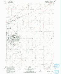
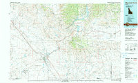 1990 Mountain Home1991 Print · USGSElmore County underwent significant expansion in the 1990s as military and transit networks matured between the mountains and the Snake River Plain. Researchers can trace the legacy of regional development through sites like Reclamation Village, the Union Pacific line, and Mountain Home Air Force Base.2 unique versions available
 - 1990 Map of The Roost, 1991 Print
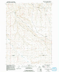
 1990 The Roost1991 Print · USGSElmore County's high-country terrain is captured here in the late twentieth century, showing a remote landscape of the Danskin Mountains. Researchers can trace the isolated Thomson Ranch and landmarks like The Roost and Cherry Gulch.
 - 1990 Map of Mayfield, 1991 Print
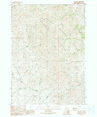
 1990 Mayfield1991 Print · USGSThe high Idaho desert meets the foothills of the Danskin Mountains in the 1990s as modern utility lines cross over old ranching grounds. Genealogists and local historians can trace the small settlements of Mayfield and Regina or locate the rural cemetery near Indian Creek.
 - 1990 Map of Danskin Peak, 1991 Print
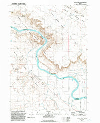
 1990 Danskin Peak1991 Print · USGSElmore County during the late twentieth century is defined by the high ridges and river canyons of the Boise National Forest. Researchers can trace the winding South Fork Boise River through the Gooseneck or locate remote landmarks like Danskin Peak and Steamboat Rock.
 - 1990 Map of Cathedral Rocks, 1991 Print
 1990 Cathedral Rocks1991 Print · USGSThe high plateau of Elmore County meets the canyonlands of the Boise National Forest during the early 1990s. Researchers can locate remote landmarks like the Smith Prairie Landing Strip, the river crossing at Danskin Bridge, and the local Cem.
 - 1992 Map of Grand View
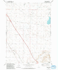
 1992 Grand View1992 Print · USGSNear the high-desert banks of the Snake River in the early nineties, this Idaho landscape reveals a unique mix of geothermal energy and river-fed ranching. Genealogists and local historians can trace family operations at Dixie Ranch, the community cemetery, and the local rodeo grounds.
 - 1992 Map of Crater Rings SW
 1992 Crater Rings SW1992 Print · USGSThe high desert south of Boise comes into focus in the early 1990s as a vital hub for military training and conservation. Researchers can trace the perimeter of the Mountain Home Air Force Base and the extensive Birds of Prey Area Boundary near the Snake River.
 - 1992 Map of Indian Butte
 1992 Indian Butte1992 Print · USGSThe high desert of southern Idaho is captured in the 1990s at the intersection of three counties, where the Oregon Trail still marks the land. Researchers can trace the path of historic migration alongside landmarks like Indian Butte and Big Pilgrim Gulch.
 - 1992 Map of Cinder Cone Butte
 1992 Cinder Cone Butte1992 Print · USGSThe high desert of Elmore County in the early 1990s was a crossroads of military training and wildlife conservation. Researchers can trace land use through the Snake River Birds of Prey Area and the Cinder Pit near Cinder Cone Butte.
 - 1992 Map of Twentymile Butte
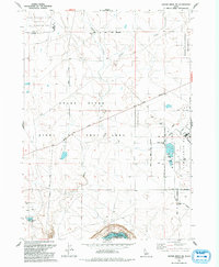
 1992 Twentymile Butte1992 Print · USGSThe high desert of southern Idaho at the start of the 1990s reveals a landscape shaped by early migration and ranching. Trace the path of the Oregon Trail as it passes near Flint Mesa or locate the remote Water Tank and Gravel Pit near the county line.
 - 1992 Map of Reverse
 1992 Reverse1992 Print · USGSElmore County's high desert plateaus and the canyon of the Snake River come into focus in this early 1990s survey. Researchers can trace historical routes along Old Highway 30 or locate local landmarks like Eureka Cave and Commerford Springs.
 - 1992 Map of Ticeska
 1992 Ticeska1992 Print · USGSThe high-desert terrain of the Snake River canyon comes into focus during the early nineties, showing where three counties meet at the water's edge. Researchers can trace infrastructure such as the Bliss Dam, the small settlement of Ticeska, and curious local routes like Main Shoestring Road.
 - 1992 Map of C.J. Strike Dam
 1992 C.J. Strike Dam1992 Print · USGSOwyhee County's river canyons and high desert come alive in the early nineties as the Snake and Bruneau rivers meet at the C J Strike Dam. Local historians can trace the Oregon Trail (South Alternate) and locate landmarks like Rimrock Jr/Sr High Sch and Little Valley.
 - 1992 Map of Crater Rings SE
 1992 Crater Rings SE1992 Print · USGSElmore County during the 1990s showcases a unique intersection of military operations and conservation efforts south of Mountain Home. Researchers can trace the developed perimeter of the Mountain Home Air Force Base and identify local features like Corral and the Snake River.
 - 1992 Map of Jackass Butte
 1992 Jackass Butte1992 Print · USGSOwyhee County's river canyon terrain is shown here in the early nineties, where the Oregon Trail meets modern conservation lands. Local historians and hikers can trace the historic trail route near Jackass Butte and locate water features like Rabbit Springs.
 - 1992 Map of Indian Cove
 1992 Indian Cove1992 Print · USGSThe Snake River corridor in Owyhee and Elmore counties is shown here in the early nineties, centered on the Birds of Prey Area. Trace historical transit lines and water infrastructure including the Old RR Grade, Indian Cove Bridge, and the aqueduct.
 - 1992 Map of Crater Rings
 1992 Crater Rings1992 Print · USGSElmore County's volcanic high desert is captured here in the early nineties, centered on the unique geologic formations of the Crater Rings. Researchers can locate the small settlements of Cleft and Sebree or trace the northern limits of the Mountain Home Air Force Base.
 - 1992 Map of Hammett
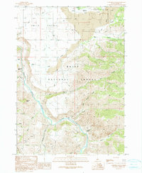
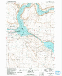
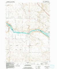
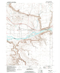 1992 Hammett1992 Print · USGSElmore County in the early nineties reveals a landscape defined by the winding Snake River and its vital transportation corridor. Researchers can trace the heritage of Hammett, locate the Medbury Ferry (Site), and find the McGuinness Ranch.
 - 1992 Map of Glenns Ferry
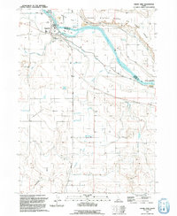
 1992 Glenns Ferry1992 Print · USGSThe Snake River valley in the early nineties remains a landscape of pioneer paths and modern military ranges. Genealogists and historians can trace the EMIGRANT TRAIL past Glenns Ferry or locate remote desert landmarks like Broken Wagon Flat and the community of Clover.
 - 1992 Map of Castle Butte
 1992 Castle Butte1992 Print · USGSOwyhee County's high desert meets the canyonlands of the Snake River in the early nineties, revealing a landscape defined by historic migration and water. Researchers can trace the Oregon Trail (South Alternate) past landmarks like Castle Butte and ranching sites such as Morgan Place.
Showing maps 1-25 of 35
Top cities of Elmore County
Frequently asked questions
- What are the different types of historical maps available for Elmore County?
- What is the oldest map of Elmore County?
- Where can I purchase historical maps of Elmore County for my home or office?
- Where can I download high-res historical maps of Elmore County?
- Are there historical topographic maps available for Elmore County?
- Is there historical aerial imagery available for Elmore County?
- Where are historical maps of Elmore County sourced from?