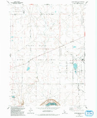
1992 Map of Crater Rings SW
USGS Topo · Published 1992About this map
Mountain Home Air Force Base occupies the eastern edge of this landscape, its structured perimeter and Small Arms Range standing in sharp contrast to the surrounding high desert terrain. To the west, the Idaho National Guard Training and Maneuver Area covers a large section of the basalt-rich plateau north of the Snake River. The map reveals a region heavily defined by federal land use and environmental conservation, highlighted by the Birds of Prey Area Boundary which protects the unique raptor habitat along the river's canyon walls.
Find a feature on this map
66 named features on this map. Tap any name to fly to it.
Don’t see what you’re looking for? This feature index may not catch every label — zoom into the map to look around manually.
Map Details
Editions of this 1992 Crater Rings SW Map
This is the sole edition of this map. No revisions or reprints were ever made.
Other maps of this area

1892 · Mountain Home
USGS Topo · 1:125,000

1892 · Bisuka
USGS Topo · 1:125,000

1893 · Mountain Home
USGS Topo · 1:125,000

1894 · Bisuka
USGS Topo · 1:125,000

1946 · Mouth of Bruneau
USGS Topo · 1:24,000

1947 · Grand View
USGS Topo · 1:62,500

1947 · Bruneau
USGS Topo · 1:62,500

1947 · Grand View
USGS Topo · 1:24,000

1947 · Bruneau
USGS Topo · 1:24,000

1947 · Dorsey Butte
USGS Topo · 1:24,000