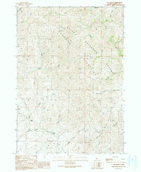
1990 Map of The Roost
USGS Topo · Published 1991About this map
The Danskin Mountains dominate this high-desert landscape within the Boise National Forest in Elmore County. The terrain is characterized by a network of drainage systems including Roost Creek, Bowns Creek, and Cherry Gulch, which carve through the peaks and ridges. Human presence is sparse, marked primarily by the Thomson Ranch and a scattered series of 4WD trails that navigate the steep contours. A solitary Prospect near the center of the sheet and a high-voltage Trans Line cutting across the southern sections suggest the remote industrial and agricultural activity of the late 20th century. The namesake feature, The Roost, stands as a prominent landmark amidst the headwaters of several drainages, illustrating the complex topography of this Idaho backcountry.
Find a feature on this map
26 named features on this map. Tap any name to fly to it.
Don’t see what you’re looking for? This feature index may not catch every label — zoom into the map to look around manually.
Map Details
Editions of this 1990 The Roost Map
This is the sole edition of this map. No revisions or reprints were ever made.
Other maps of this area

1892 · Mountain Home
USGS Topo · 1:125,000

1893 · Mountain Home
USGS Topo · 1:125,000

1894 · Idaho Basin
USGS Topo · 1:125,000

1955 · Hailey
USGS Topo · 1:250,000

1959 · Hailey
USGS Topo · 1:250,000

1960 · Mayfield
USGS Topo · 1:62,500

1960 · Danskin Peak
USGS Topo · 1:62,500

1962 · Hailey
USGS Topo · 1:250,000
1964 · Long Gulch
USGS Topo · 1:24,000
1969 · Grape Mtn
USGS Topo · 1:24,000