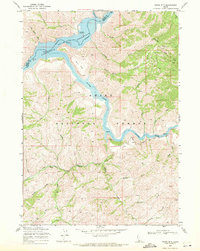
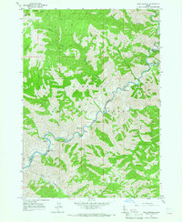
1969 Map of Grape Mtn
USGS Topo · Published 1971About this map
The South Fork Boise River winds through the central corridor of this Boise National Forest landscape, feeding into the expansive waters of the Arrowrock Reservoir. This 1969 field-checked survey reveals a rugged backcountry defined by numerous drainage systems, including Deadman Creek and Lime Creek, that carve through the high-elevation terrain around Grape Mtn. Transportation through this steep canyon country is limited, centered primarily on the winding path of Blacks Creek Road and several unimproved tracks that navigate the ridges.
Find a feature on this map
37 named features on this map. Tap any name to fly to it.
Don’t see what you’re looking for? This feature index may not catch every label — zoom into the map to look around manually.
Map Details
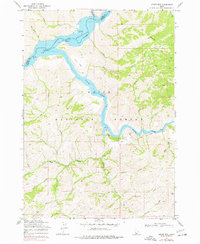
Editions of this 1969 Grape Mtn Map
2 editions found
Other maps of this area

1892 · Mountain Home
USGS Topo · 1:125,000

1893 · Mountain Home
USGS Topo · 1:125,000

1894 · Idaho Basin
USGS Topo · 1:125,000

1955 · Hailey
USGS Topo · 1:250,000

1959 · Hailey
USGS Topo · 1:250,000
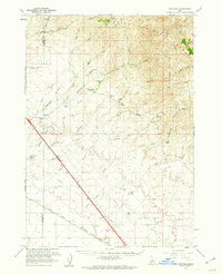
1960 · Mayfield
USGS Topo · 1:62,500
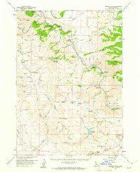
1960 · Danskin Peak
USGS Topo · 1:62,500

1962 · Hailey
USGS Topo · 1:250,000
1964 · Twin Springs
USGS Topo · 1:24,000
1964 · Long Gulch
USGS Topo · 1:24,000