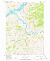
1969 Map of Grape Mtn
USGS Topo · Published 1977About this map
Arrowrock Reservoir and the South Fork Boise River dominate this canyon-heavy landscape within the Boise National Forest as it appeared in the late 1960s. The survey captures the sharp topography around Grape Mtn and the unique landmark of Rock Pinnacle, where the river makes a dramatic westward turn. This is a region defined by its hydrology and drainage patterns, with numerous named gulches and creeks such as Nibbler Gulch, Soap Creek, and Deadman Creek feeding the larger river system.
Find a feature on this map
34 named features on this map. Tap any name to fly to it.
Don’t see what you’re looking for? This feature index may not catch every label — zoom into the map to look around manually.
Map Details
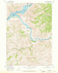
Editions of this 1969 Grape Mtn Map
2 editions found
Other maps of this area

1892 · Mountain Home
USGS Topo · 1:125,000

1893 · Mountain Home
USGS Topo · 1:125,000

1894 · Idaho Basin
USGS Topo · 1:125,000

1955 · Hailey
USGS Topo · 1:250,000

1959 · Hailey
USGS Topo · 1:250,000

1960 · Mayfield
USGS Topo · 1:62,500

1960 · Danskin Peak
USGS Topo · 1:62,500

1962 · Hailey
USGS Topo · 1:250,000

1964 · Twin Springs
USGS Topo · 1:24,000
1964 · Long Gulch
USGS Topo · 1:24,000