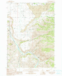
1990 Map of Cathedral Rocks
USGS Topo · Published 1991About this map
Smith Prairie dominates the northern landscape of this Elmore County region, characterized by a high plateau that transitions into the steep canyon of the South Fork Boise River. The river winds through the southern half of the map, crossed by the Danskin Bridge and bordered by the Boise National Forest. The presence of the Smith Prairie Landing Strip, a Radio Facility, and numerous prospects suggests a remote area managed for both resource extraction and backcountry access. Geological landmarks like the Cathedral Rocks, Steamboat Rock, and a notable flow of Lava define the terrain's character. Small traces of human activity appear in the form of a Cem and the settlement of Horse, while a complex system of water management is visible through a labeled Ditch network across the prairie.
Find a feature on this map
32 named features on this map. Tap any name to fly to it.
Don’t see what you’re looking for? This feature index may not catch every label — zoom into the map to look around manually.
Map Details
Editions of this 1990 Cathedral Rocks Map
This is the sole edition of this map. No revisions or reprints were ever made.
Other maps of this area

1892 · Mountain Home
USGS Topo · 1:125,000

1892 · Camas Prairie
USGS Topo · 1:125,000

1893 · Mountain Home
USGS Topo · 1:125,000

1893 · Camas Prairie
USGS Topo · 1:125,000

1894 · Idaho Basin
USGS Topo · 1:125,000

1894 · Rocky Bar
USGS Topo · 1:125,000

1955 · Hailey
USGS Topo · 1:250,000

1959 · Hailey
USGS Topo · 1:250,000

1960 · Danskin Peak
USGS Topo · 1:62,500

1962 · Hailey
USGS Topo · 1:250,000