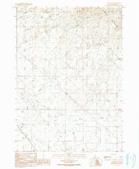
1990 Map of Mayfield SE
USGS Topo · Published 1991About this map
The Danskin Mountains dominate the northeastern portion of this Idaho landscape, where the terrain transitions into a complex network of seasonal drainages and technical infrastructure. Water management is a primary theme of the area, evidenced by the presence of Mud Springs and several named watercourses including Soles Creek, Dry Creek, and Spring Creek. The map documents a workspace of utilitarian features, including an Abandoned Ditch and a contemporary Pipeline that cuts across the southern sections.
Find a feature on this map
19 named features on this map. Tap any name to fly to it.
Don’t see what you’re looking for? This feature index may not catch every label — zoom into the map to look around manually.
Map Details
Editions of this 1990 Mayfield SE Map
This is the sole edition of this map. No revisions or reprints were ever made.
Other maps of this area

1892 · Mountain Home
USGS Topo · 1:125,000

1893 · Mountain Home
USGS Topo · 1:125,000

1955 · Hailey
USGS Topo · 1:250,000
1956 · Cinder Cone Butte
USGS Topo · 1:24,000

1956 · Crater Rings
USGS Topo · 1:24,000

1956 · Mountain Home North
USGS Topo · 1:24,000

1956 · Mountain Home
USGS Topo · 1:62,500

1959 · Hailey
USGS Topo · 1:250,000

1960 · Mayfield
USGS Topo · 1:62,500

1960 · Danskin Peak
USGS Topo · 1:62,500