1960s Maps of Elmore County, Idaho
Explore 27 historic maps of Elmore County from the 1960s. These maps offer a rare glimpse into what life looked like during the 1960s — showing old roads, neighborhoods, homes, and landmarks that have changed or disappeared over time.
Whether you're researching your family's past, planning a metal detecting trip, or studying how Elmore County's landscape evolved across the 1960s, these high-resolution maps are a powerful tool for exploring the history of this region.
- Focus on a specific era: All maps on this page are from the 1960s, giving you a focused view of this time period.
- See what’s changed: Compare century-old streets, trails, and buildings to today's modern landscape using overlays and satellite layers.
- Research with precision: Use these maps for genealogy, historical research, land use analysis, or educational projects.
- View, download, or print: Maps are fully viewable online in high resolution, and can be downloaded or printed for your own records.
Start exploring Elmore County's history through authentic maps from the 1960s. This is your window into the past.
Elmore County, ID maps
(27)- 1960 Map of Challis
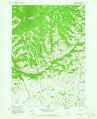
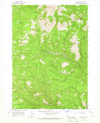
 1960 Challis1960 Print · USGSCentral Idaho’s high backcountry is detailed here in the early sixties, showing the remote ranching and mining life across five national forests. Genealogists and researchers can trace family holdings at the Silva Ranch or Jones Ranch and find historic sites like Redfish Lake Lodge and Clayton.
 - 1960 Map of Mayfield, 1962 Print
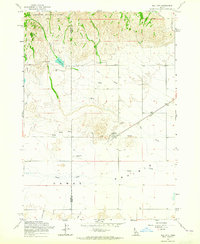
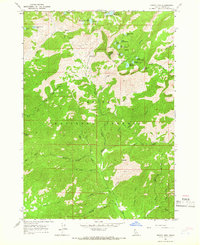
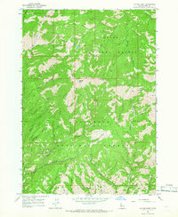
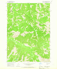
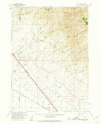 1960 Mayfield1962 Print · USGSElmore County's ranching and rail landscape is preserved here during the early sixties, showing the transition from the high desert to the national forest. Researchers can locate the Regina (Site) and trace the Union Pacific railroad past historic sites like Seven L Ranch and the local cemetery.3 unique versions available
 - 1960 Map of Danskin Peak, 1962 Print
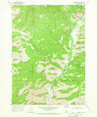
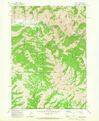
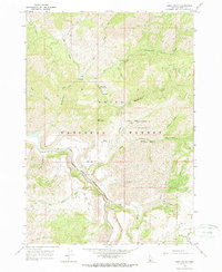
 1960 Danskin Peak1962 Print · USGSElmore County’s high forest and river country are documented here in the early sixties, showing the remote stations and ranch lands of the Boise National Forest. Researchers can find old backcountry outposts like Willow Creek Guard Station and family landmarks such as Long Tom Ranch and Tollgate Hill.3 unique versions available
 - 1962 Map of Boise
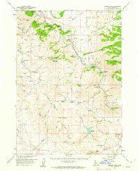
 1962 Boise1962 Print · USGSThe Treasure Valley at the start of the sixties reveals a landscape of expanding towns and complex irrigation networks along the Snake River. Genealogists and historians can trace the foundations of modern Idaho through markers like Initial Point, the mining history of Silver City, and the early infrastructure of Lucky Peak Dam.
 - 1962 Map of Hailey
 1962 Hailey1962 Print · USGSCentral Idaho in the early sixties showcases a landscape of high-altitude ranching and mining at the foot of the Sawtooth Mountains. Genealogists and historians can trace the rail-and-river economy through the Union Pacific Railroad corridor and explore old mining sites like the Triumph Mine or Silver Star Queens Mine.
 - 1963 Map of Challis
 1963 Challis1963 Print · USGSCentral Idaho's mountain corridors and mining districts appear in detail during the early sixties, highlighting the remote settlements of Challis and Stanley. Researchers can trace the legacy of the gold and silver rushes through labels for Bonanza, the Bayhorse Mine, and the Falconberry ranch.
 - 1963 Map of High Prairie, 1964 Print
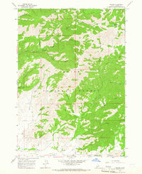
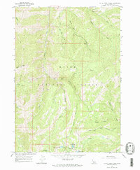
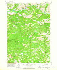
 1963 High Prairie1964 Print · USGSElmore County ranching and timberlands are captured here during the early sixties, showing the vital grazing connection between forest and basin. Genealogists and historians can trace the Sheep Drive Trail and local landmarks like Moores Flat and Moores Spring.2 unique versions available
 - 1963 Map of Deer Mountain, 1964 Print
 1963 Deer Mountain1964 Print · USGSCamas County's high-country wilderness is shown here in the early sixties, a landscape of the Sawtooth National Forest defined by complex drainage systems and remote trails. You can trace early access routes like the High Trail and locate landmarks such as Deer Mountain and Cold Spring Ridge.3 unique versions available
 - 1963 Map of Sprout Mtn, 1964 Print
 1963 Sprout Mtn1964 Print · USGSElmore County’s high backcountry in the Sawtooth National Forest is captured here during the early sixties. Researchers can trace historic sheep-herding routes like Sheep Drive Trail, locate early mining activity at Prospects, and find isolated landmarks such as Sprout Mtn.
 - 1963 Map of Hill City, 1965 Print
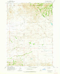
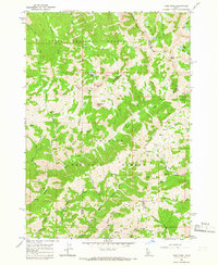
 1963 Hill City1965 Print · USGSThe Idaho high desert meets the foothills in the 1960s, showing the intersection of ranching and rail. Genealogists and historians can trace the Union Pacific tracks through Hill City, locating the Hill City Cem and County Line Sch.
 - 1964 Map of Featherville, 1965 Print
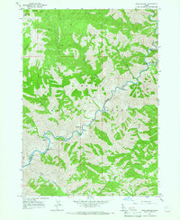
 1964 Featherville1965 Print · USGSElmore County during the mid-sixties centers on the riverside communities along the Boise River. Trace family roots and mountain landmarks near Featherville and Dixie, or locate backcountry sites like Paradise Hot Springs and the Diamond Bar Airstrip.3 unique versions available
 - 1964 Map of Prairie, 1965 Print
 1964 Prairie1965 Print · USGSElmore County's high-country ranching and forest lands are captured in the 1960s, showing the intersection of back-country trails and mountain wilderness. Researchers can locate remote landmarks like Smith Prairie Airstrip, the Pierce Ditch, and Tipton Flat Campground.2 unique versions available
 - 1964 Map of Trinity Mtn, 1966 Print
 1964 Trinity Mtn1966 Print · USGSElmore County's high alpine backcountry is preserved here as it appeared in the mid-1960s, dominated by the peaks of the Boise National Forest. Backpackers and historians can trace old pack trails to remote waters like Big Rainbow Lake or the high Trinity Mtn Lookout.3 unique versions available
 - 1964 Map of Little Trinity Lake, 1966 Print
 1964 Little Trinity Lake1966 Print · USGSElmore County's high country is captured here in the mid-1960s, showing a network of remote alpine lakes and forest service outposts. Researchers can trace historic access routes via pack trails to the Trinity Lakes Guard Station and Little Trinity Lake.2 unique versions available
 - 1964 Map of Ross Peak, 1966 Print
 1964 Ross Peak1966 Print · USGSThe high Idaho wilderness of the mid-sixties is mapped here through its intricate trail networks and remote mining claims. Researchers can trace old routes along Willow Creek and locate historic operations like the Red Horse Mine and multiple Prospects.3 unique versions available
 - 1964 Map of Sheep Creek, 1966 Print
 1964 Sheep Creek1966 Print · USGSElmore County during the mid-1960s was a landscape of remote national forest and river canyons. Researchers can locate early recreational sites like Repeat Creek Campground and trace the paths of old mountain trails near Sheep Mountain and the Middle Fork Boise River.
 - 1964 Map of Twin Springs, 1966 Print
 1964 Twin Springs1966 Print · USGSThe Boise National Forest backcountry comes into focus in the mid-1960s, showing the rugged canyon lands at the confluence of the Boise River and the North Fork. Researchers can trace old mountain routes like the Pack Trail or locate remote sites including Twin Springs, the Troutdale Guard Sta, and several geothermal Hot Springs.3 unique versions available
 - 1964 Map of Cayuse Point, 1966 Print
 1964 Cayuse Point1966 Print · USGSElmore County's backcountry is captured during the mid-1960s, showing a rugged landscape where the Boise National Forest meets the Sawtooths. Researchers can locate the historic Bonaparte Mine, trace the winding path of Shake Creek, and find remote landmarks like Corbus Lake.2 unique versions available
 - 1964 Map of Jumbo Mtn, 1966 Print
 1964 Jumbo Mtn1966 Print · USGSThe Sawtooth National Forest landscape during the mid-sixties reveals a transition from river-bottom activity to high-mountain surveillance. Outdoor enthusiasts and historians can trace routes along the South Fork Boise River to the Iron Mtn Lookout and Baumgartner Campground.3 unique versions available
 - 1964 Map of Grouse Butte, 1966 Print
 1964 Grouse Butte1966 Print · USGSElmore County's high country is captured here during the mid-sixties, showing a landscape defined by the winding South Fork Boise River and deep forest reaches. Genealogists and historians can locate remote landmarks such as the Shake Creek Ranger Station, Schoolhouse Gulch, and several early Sawtooth National Forest campgrounds.2 unique versions available
 - 1964 Map of Snowyside Peak, 1966 Print
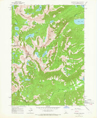 1964 Snowyside Peak1966 Print · USGSThe high Sawtooth summits of the mid-1960s reveal a landscape of glacial lakes and county boundaries at the headwaters of the Payette River. Trace the early access routes to Alturas Lake, the remote prospect at Eureka Gulch, and the Alturas Inlet Campground.4 unique versions available
 - 1964 Map of Rocky Bar, 1966 Print
 1964 Rocky Bar1966 Print · USGSElmore County’s mountain mining country is captured here in the mid-sixties, showing the intersection of national forests and old gold-rush history. Researchers can locate the Spanish Town (Site) and the settlement at Rocky Bar, or trace primitive routes like the Pack Trail near Steel Mountain.
 - 1964 Map of Marshall Peak, 1966 Print
 1964 Marshall Peak1966 Print · USGSThe Idaho backcountry in the mid-1960s was a landscape of high alpine peaks and isolated mining claims. Genealogists and historians can locate remote operations like the Silver King Mine and Pilgrim Mine or trace trails through the Ross Fork Basin.2 unique versions available
 - 1964 Map of Long Gulch, 1966 Print
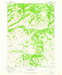
 1964 Long Gulch1966 Print · USGSThe South Fork of the Boise River flows through this Idaho wilderness in the mid-1960s, a period of active forest management and primitive backcountry travel. Genealogists and researchers can trace the locations of the Long Gulch Guard Station, Rattlesnake Campground, and numerous family-named drainages like Smith Creek.
 - 1969 Map of Arrowrock Reservoir NE, 1971 Print
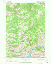 1969 Arrowrock Reservoir NE1971 Print · USGSThe Boise River basin in the late 1960s shows a landscape of steep gulches and mountain peaks managed for forest service and recreation. Researchers can locate remote sites like the Cottonwood Ranger Sta, Thorn Creek Butte, and several campgrounds along Arrowrock Reservoir.2 unique versions available
Showing maps 1-25 of 27
Top cities of Elmore County
Frequently asked questions
- What are the different types of historical maps available for Elmore County?
- What is the oldest map of Elmore County?
- Where can I purchase historical maps of Elmore County for my home or office?
- Where can I download high-res historical maps of Elmore County?
- Are there historical topographic maps available for Elmore County?
- Is there historical aerial imagery available for Elmore County?
- Where are historical maps of Elmore County sourced from?