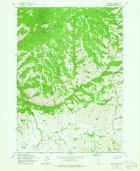
1963 Map of Sprout Mtn
USGS Topo · Published 1964About this map
Sawtooth National Forest dominates this mid-century landscape in Elmore County, revealing a wilderness defined by its drainage basins and high peaks like Sprout Mtn. The terrain is deeply incised by water systems, including Lime Creek and the South Fork Deer Creek, which carved the steep gulches that traverse the region. Resource extraction and seasonal movement are evident through the presence of a Mine and several Prospects located near Hawk Gulch, alongside the Sheep Drive Trail and Sheep Trail Drive which cross the southern reaches of the quadrangle.
Find a feature on this map
33 named features on this map. Tap any name to fly to it.
Don’t see what you’re looking for? This feature index may not catch every label — zoom into the map to look around manually.
Map Details
Editions of this 1963 Sprout Mtn Map
This is the sole edition of this map. No revisions or reprints were ever made.
Other maps of this area

1892 · Camas Prairie
USGS Topo · 1:125,000

1893 · Camas Prairie
USGS Topo · 1:125,000

1894 · Rocky Bar
USGS Topo · 1:125,000

1955 · Hailey
USGS Topo · 1:250,000

1959 · Hailey
USGS Topo · 1:250,000

1962 · Hailey
USGS Topo · 1:250,000

1963 · High Prairie
USGS Topo · 1:24,000

1963 · Deer Mountain
USGS Topo · 1:24,000

1963 · Hill City
USGS Topo · 1:24,000
1964 · Featherville
USGS Topo · 1:24,000