
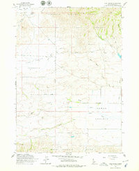
1963 Map of High Prairie
USGS Topo · Published 1964About this map
Sawtooth National Forest dominates the northern landscape of this Idaho interior, where the transition from high timber to open range is marked by the broad expanse of High Prairie. The 1963 survey documents a remote ranching and grazing corridor, evidenced by the prominent Sheep Drive Trail winding across the northern ridges. To the south, the terrain descends toward the Camas Prairie, a distinct topographic basin defined by the confluence of the Malad River and Camas Creek. These watercourses, along with smaller tributaries like Wild Horse Creek and Negro Creek, delineate the essential drainage patterns that supported seasonal livestock movement between the high forest and the Mount Bennett Hills to the south. Local landmarks such as Moores Flat and Moores Spring anchor specific corners of this high-elevation plateau, while a network of jeep trails indicates the rugged, utilitarian access typical of the mid-century western range.
Find a feature on this map
21 named features on this map. Tap any name to fly to it.
Don’t see what you’re looking for? This feature index may not catch every label — zoom into the map to look around manually.
Map Details
Editions of this 1963 High Prairie Map
2 editions found
Other maps of this area

1892 · Camas Prairie
USGS Topo · 1:125,000

1893 · Camas Prairie
USGS Topo · 1:125,000

1955 · Hailey
USGS Topo · 1:250,000
1958 · Bennett Mtn
USGS Topo · 1:62,500

1958 · King Hill
USGS Topo · 1:62,500

1959 · Hailey
USGS Topo · 1:250,000

1962 · Hailey
USGS Topo · 1:250,000

1963 · Deer Mountain
USGS Topo · 1:24,000
1963 · Sprout Mtn
USGS Topo · 1:24,000

1963 · Hill City
USGS Topo · 1:24,000