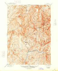
1894 Map of Rocky Bar
USGS Topo · Published 1948About this map
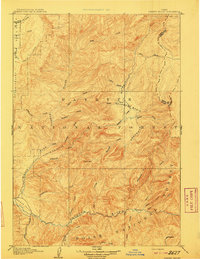
The mountain mining camps of the Boise Basin are preserved here as they stood in the early 1890s, when the rugged Idaho backcountry was defined by isolated settlements and a complex web of river forks. Rocky Bar and Atlanta serve as the primary hubs of activity, situated deep within the drainages that would eventually be designated as the Boise National Forest and Sawtooth National Forest. The map documents a landscape before modern roads, where travel relied on following the courses of the South Fork Boise River and its numerous tributaries like Feather Creek and Steel Creek. Notable landmarks such as Steel Mt. and Trinity Mt. overlook the high-altitude terrain, providing essential orientation for prospectors and settlers. The placement of Junction Bar and the remote outpost of Graham illustrates the precarious nature of these mountain communities during the peak of Idaho's 19th-century mineral exploration.
Find a feature on this map
35 named features on this map. Tap any name to fly to it.
Don’t see what you’re looking for? This feature index may not catch every label — zoom into the map to look around manually.
Map Details
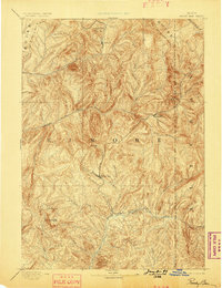
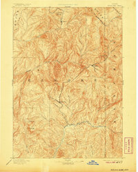
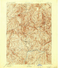
Editions of this 1894 Rocky Bar Map
5 editions found
Other maps of this area

1891 · Bear Valley
USGS Topo · 1:125,000

1892 · Mountain Home
USGS Topo · 1:125,000

1892 · Camas Prairie
USGS Topo · 1:125,000

1893 · Mountain Home
USGS Topo · 1:125,000

1893 · Bear Valley
USGS Topo · 1:125,000

1893 · Camas Prairie
USGS Topo · 1:125,000

1894 · Idaho Basin
USGS Topo · 1:125,000

1894 · Rocky Bar
USGS Topo · 1:125,000

1900 · Sawtooth
USGS Topo · 1:125,000
1909 · Garden Valley
USGS Topo · 1:125,000