
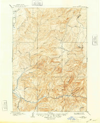
1909 Map of Garden Valley
USGS Topo · Published 1909About this map
Scott Mtn serves as a central landmark in this 1890s-era survey, overlooking a landscape defined by the deep canyons and high ridges of the Payette National Forest and Boise National Forest. The map documents a period before modern water management, showing the natural course of the Deadwood River as it flows through the Deadwood Basin and the Payette River south of Garden Valley. Early settlements such as Lowman and Banner appear as isolated outposts along the riverbanks and mining-adjacent drainages like Grimes Creek. The intricate drainage system, including Silver Creek, Bulldog Creek, and Thunder Creek, illustrates the complex topography that governed early travel and resource extraction in the region. Notable geographic features like Lightning Ridge and Round Valley emphasize the sharp elevation changes that characterize this portion of the Idaho backcountry.
Find a feature on this map
42 named features on this map. Tap any name to fly to it.
Don’t see what you’re looking for? This feature index may not catch every label — zoom into the map to look around manually.
Map Details
Editions of this 1909 Garden Valley Map
2 editions found
Other maps of this area

1891 · Bear Valley
USGS Topo · 1:125,000

1892 · Boise
USGS Topo · 1:125,000

1893 · Bear Valley
USGS Topo · 1:125,000

1894 · Squaw Creek
USGS Topo · 1:125,000

1894 · Idaho Basin
USGS Topo · 1:125,000

1894 · Rocky Bar
USGS Topo · 1:125,000

1897 · Boise
USGS Topo · 1:125,000

1911 · Meadows
USGS Topo · 1:125,000

1953 · Smiths Ferry
USGS Topo · 1:62,500

1953 · Boiling Springs
USGS Topo · 1:62,500