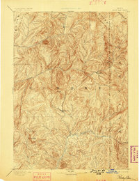
1894 Map of Rocky Bar
USGS Topo · Published 1899About this map
Rocky Bar serves as a central point of settlement in this 1891 survey of the Idaho high country, where the drainage systems of the Boise River basin define the topography. The map detail highlights the gold mining era's geography, particularly around Atlanta and the remote outpost of Graham near Silver Mt. Further south, the confluence at Junction Bar marks a critical junction where the South Fork Boise River meets Feather River.
Find a feature on this map
30 named features on this map. Tap any name to fly to it.
Don’t see what you’re looking for? This feature index may not catch every label — zoom into the map to look around manually.
Map Details
Editions of this 1894 Rocky Bar Map
5 editions found
Other maps of this area

1891 · Bear Valley
USGS Topo · 1:125,000

1892 · Mountain Home
USGS Topo · 1:125,000

1892 · Camas Prairie
USGS Topo · 1:125,000

1893 · Mountain Home
USGS Topo · 1:125,000

1893 · Bear Valley
USGS Topo · 1:125,000

1893 · Camas Prairie
USGS Topo · 1:125,000

1894 · Idaho Basin
USGS Topo · 1:125,000

1894 · Rocky Bar
USGS Topo · 1:125,000

1900 · Sawtooth
USGS Topo · 1:125,000

1909 · Garden Valley
USGS Topo · 1:125,000