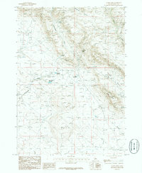
1986 Map of Teapot Dome
USGS Topo · Published 1986About this map
Teapot Dome rises as a prominent landmark in this high-desert landscape of Elmore County, documented here as it appeared in the mid-1980s. The area is defined by a network of drainage systems and vital water sources, including the perennial flow of Rattlesnake Creek and Bennett Creek. Human management of this arid environment is evident through several named catchments, such as John Hoffman Reservoir, Lamberton Reservoir, and Keith Reservoir, which provided essential water storage for local ranching or agricultural needs.
Find a feature on this map
14 named features on this map. Tap any name to fly to it.
Don’t see what you’re looking for? This feature index may not catch every label — zoom into the map to look around manually.
Map Details
Editions of this 1986 Teapot Dome Map
This is the sole edition of this map. No revisions or reprints were ever made.
Other maps of this area

1892 · Mountain Home
USGS Topo · 1:125,000

1892 · Camas Prairie
USGS Topo · 1:125,000

1893 · Mountain Home
USGS Topo · 1:125,000

1893 · Camas Prairie
USGS Topo · 1:125,000

1955 · Hailey
USGS Topo · 1:250,000
1956 · Mountain Home South
USGS Topo · 1:24,000
1956 · Reverse
USGS Topo · 1:24,000

1956 · Mountain Home North
USGS Topo · 1:24,000

1956 · Mountain Home
USGS Topo · 1:62,500
1958 · Bennett Mtn
USGS Topo · 1:62,500