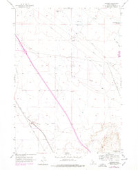
1956 Map of Reverse
USGS Topo · Published 1978About this map
The Union Pacific railroad and the Old Oregon Trail Highway converge at the small settlement of Reverse, providing a look at the historical transit corridor through Elmore County. This map, based on mid-1950s data with later revisions, shows a landscape defined by industrial infrastructure and natural landmarks. Multiple Pipeline corridors cross the terrain, while water features like the Hot Springs Creek Reservoir and Commerford Springs indicate the vital role of water management in this arid region. The presence of Eureka Cave and the VABM Brush 3291 survey marker offer specific points of interest for those tracking local topography and geologic features. The layout of the roads and rail line highlights the geographic constraints and historical paths established by early western migration and the subsequent development of Idaho's transportation network.
Find a feature on this map
11 named features on this map. Tap any name to fly to it.
Don’t see what you’re looking for? This feature index may not catch every label — zoom into the map to look around manually.
Map Details
Editions of this 1956 Reverse Map
Other maps of this area

1892 · Mountain Home
USGS Topo · 1:125,000

1892 · Camas Prairie
USGS Topo · 1:125,000

1893 · Mountain Home
USGS Topo · 1:125,000

1893 · Camas Prairie
USGS Topo · 1:125,000

1947 · Indian Cove
USGS Topo · 1:24,000

1947 · Hammett
USGS Topo · 1:24,000

1947 · Sand Dunes
USGS Topo · 1:24,000

1948 · Sand Dunes
USGS Topo · 1:24,000

1948 · Hammett
USGS Topo · 1:24,000

1948 · Indian Cove
USGS Topo · 1:24,000