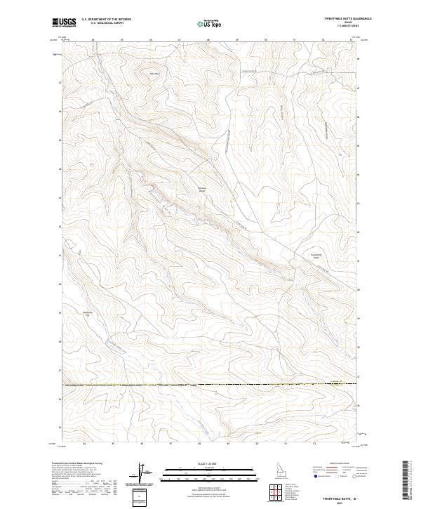
2023 Map of Twentymile Butte
USGS Topo · Published 2023About this map
Bruneau Desert dominates this high-altitude landscape along the border of Elmore and Owyhee counties. The terrain is defined by deep incisions and high overlooks, notably Twentymile Butte and the broad Flint Mesa to the north. A network of unpaved roads, including E Flint Mesa Rd and Glenns Ferry Castleford Rd, provides the primary access through this dry expanse, connecting remote grazing or transit points. To the west, the land levels out slightly at Deadman Flat before dropping into the drainage of Deadman Creek. The map documents a sparsely populated but distinctly named geography where erosion has carved features like Rosevear Gulch and Big Pilgrim Gulch, illustrating the isolated character of this high desert region in the modern era.
Find a feature on this map
19 named features on this map. Tap any name to fly to it.
Don’t see what you’re looking for? This feature index may not catch every label — zoom into the map to look around manually.
Map Details
Editions of this 2023 Twentymile Butte Map
This is the sole edition of this map. No revisions or reprints were ever made.
Other maps of this area

1947 · Glenns Ferry
USGS Topo · 1:24,000

1947 · Pasadena Valley
USGS Topo · 1:24,000

1948 · Pasadena Valley
USGS Topo · 1:24,000

1948 · Glenns Ferry
USGS Topo · 1:24,000

1948 · Twentymile Butte
USGS Topo · 1:24,000

1948 · Glenns Ferry
USGS Topo · 1:62,500

1948 · Ticeska
USGS Topo · 1:24,000

1948 · Grindstone Butte
USGS Topo · 1:24,000
1949 · Grindstone Butte
USGS Topo · 1:24,000

1949 · Ticeska
USGS Topo · 1:24,000