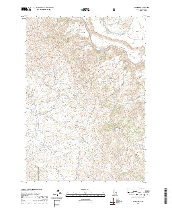
2023 Map of Danskin Peak
USGS Topo · Published 2023About this map
The Danskin Mountains dominate this high-elevation landscape within the Boise National Forest, centered on the prominent Danskin Peak. This 2023 survey details a network of ridges and deep drainages, most notably the path of the South Fork Boise River as it cuts across the northern reaches of the quadrangle. High plateaus like Smith Prairie and Little Fiddler Flat contrast with the steep relief of Devils Hole and Long Gulch.
Find a feature on this map
55 named features on this map. Tap any name to fly to it.
Don’t see what you’re looking for? This feature index may not catch every label — zoom into the map to look around manually.
Map Details
Editions of this 2023 Danskin Peak Map
This is the sole edition of this map. No revisions or reprints were ever made.
Other maps of this area

1892 · Mountain Home
USGS Topo · 1:125,000

1893 · Mountain Home
USGS Topo · 1:125,000

1894 · Idaho Basin
USGS Topo · 1:125,000

1955 · Hailey
USGS Topo · 1:250,000

1959 · Hailey
USGS Topo · 1:250,000

1960 · Mayfield
USGS Topo · 1:62,500

1960 · Danskin Peak
USGS Topo · 1:62,500

1962 · Hailey
USGS Topo · 1:250,000
1964 · Prairie
USGS Topo · 1:24,000
1964 · Long Gulch
USGS Topo · 1:24,000