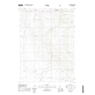
2020 Map of Syrup Creek
USGS Topo · Published 2020About this map
The Danskin Mountains dominate the northeastern landscape of this Elmore County region, which is largely defined by the drainage basins within the Boise National Forest. The map illustrates a rugged network of seasonal and perennial waterways, most notably Syrup Creek and Long Tom Creek, which carve deep canyons and gulches like Teetors Gulch and Dixie Gulch. The presence of Emigrant Cove and the namesake Immigrant Road along the southern border suggests a historical corridor of travel through this high-elevation terrain. Access to the interior is provided by forest service roads such as Nat For Dev Rd 167 and local routes like Canyon Creek Road, which navigate the elevation changes between Big Bluff and the various creek forks. Natural water sources like Cottonwood Springs appear as vital landmarks in this arid, high-country environment.
Find a feature on this map
34 named features on this map. Tap any name to fly to it.
Don’t see what you’re looking for? This feature index may not catch every label — zoom into the map to look around manually.
Map Details
Editions of this 2020 Syrup Creek Map
This is the sole edition of this map. No revisions or reprints were ever made.
Other maps of this area

1892 · Mountain Home
USGS Topo · 1:125,000

1893 · Mountain Home
USGS Topo · 1:125,000

1955 · Hailey
USGS Topo · 1:250,000

1956 · Crater Rings
USGS Topo · 1:24,000

1956 · Mountain Home North
USGS Topo · 1:24,000

1956 · Mountain Home
USGS Topo · 1:62,500

1959 · Hailey
USGS Topo · 1:250,000

1960 · Mayfield
USGS Topo · 1:62,500

1960 · Danskin Peak
USGS Topo · 1:62,500

1962 · Hailey
USGS Topo · 1:250,000